Sugarloaf Mountain (Dutchess County, New York) facts for kids
This page is about the mountain near Breakneck Ridge. For the hill south of Garrison, see Sugarloaf Hill (Putnam County, New York).
Quick facts for kids Sugarloaf Mountain |
|
|---|---|

Sugarloaf from the Breakneck Bypass Trail
|
|
| Highest point | |
| Elevation | 900 ft (270 m) |
| Prominence | 300 ft (91 m) |
| Isolation | 0.7 mi (1.1 km) |
| Parent peak | Breakneck Ridge |
| Geography | |
| Parent range | Hudson Highlands |
| Topo map | West Point |
| Climbing | |
| Easiest route | Trail |
| Access | Public |
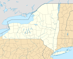
Sugarloaf Mountain is a 900-foot (270 m) peak located in the town of Fishkill near the Hudson River and Breakneck Ridge. One of several similarly named mountains in the U.S. state of New York, it is part of the Hudson Highlands, located entirely within Hudson Highlands State Park.
It can be climbed via the Wilkinson Memorial Trail, which has its western trailhead a mile (1.6 km) from the summit on New York State Route 9D along the Hudson River, opposite the Breakneck Ridge station on Metro-North Railroad's Hudson Line. The trail climbs gently at first but then steeply as it approaches the summit plateau. At either end there are panoramic views over the river's Newburgh Bay, surrounding mountains and nearby communities.

All content from Kiddle encyclopedia articles (including the article images and facts) can be freely used under Attribution-ShareAlike license, unless stated otherwise. Cite this article:
Sugarloaf Mountain (Dutchess County, New York) Facts for Kids. Kiddle Encyclopedia.

