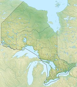
Sturgeon Lake (north Kenora District) facts for kids
For other places with the same name, see Sturgeon Lake (disambiguation).
Quick facts for kids Sturgeon Lake |
|
|---|---|
| Location | Kenora District, Ontario |
| Coordinates | 55°23′48″N 90°54′19″W / 55.39667°N 90.90528°W |
| Primary inflows | Sturgeon River |
| Primary outflows | Sturgeon River |
| Basin countries | Canada |
| Max. length | 24.4 km (15.2 mi) |
| Max. width | 1 km (0.6 mi) |
| Surface area | 14 km2 (5 sq mi) |
| Shore length1 | 45 km (28.0 mi) |
| Surface elevation | 88 m (289 ft) |
| 1 Shore length is not a well-defined measure. | |
Sturgeon Lake is a long, thin lake located in the Kenora District of Northwestern Ontario, Canada, 200 km (124 mi) along the Manitoba-Ontario border from Hudson Bay and 6.5 km (4.0 mi) from the Manitoba border.
The Sturgeon River flows north-west into and out of the lake, and eventually flows into Hudson Bay via the Hayes River.

All content from Kiddle encyclopedia articles (including the article images and facts) can be freely used under Attribution-ShareAlike license, unless stated otherwise. Cite this article:
Sturgeon Lake (north Kenora District) Facts for Kids. Kiddle Encyclopedia.

