Strait of Gibraltar facts for kids
Quick facts for kids Strait of Gibraltar |
|
|---|---|

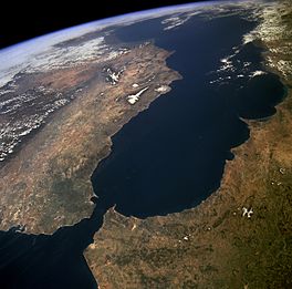
The Strait of Gibraltar as seen from space.
The Iberian Peninsula is on the left and North Africa is on the right. |
|
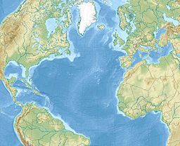
| Location | Atlantic Ocean – Mediterranean Sea |
| Coordinates | 35°58′N 5°29′W / 35.967°N 5.483°W |
| Type | Strait |
| Native name | |
| Basin countries | |
| Min. width | 13 km (8.1 mi) |
| Max. depth | 900 metres (2,953 ft) |
The Strait of Gibraltar (Arabic: مضيق جبل طارق, romanized: Maḍīq Jabal Ṭāriq; Spanish: Estrecho de Gibraltar) is a narrow strait that connects the Atlantic Ocean to the Mediterranean Sea and separates Gibraltar and Peninsular Spain in Europe from Morocco in Africa.
The two continents are separated by 14.3 kilometres (8.9 miles; 7.7 nautical miles) of ocean at the Strait's narrowest point. The Strait's depth ranges between 300 and 900 metres (980 and 2,950 feet; 160 and 490 fathoms) which possibly interacted with the lower mean sea level of the last major glaciation 20,000 years ago when the level of the sea is believed to have been lower by 110–120 m (360–390 ft; 60–66 fathoms). Ferries cross between the two continents every day in as little as 35 minutes. The Spanish side of the Strait is protected under El Estrecho Natural Park.
Images for kids
-
Historic map of the Strait of Gibraltar by Piri Reis.
See also
 In Spanish: Estrecho de Gibraltar para niños


