Springlands, Queensland facts for kids
Quick facts for kids SpringlandsQueensland |
|||||||||||||||
|---|---|---|---|---|---|---|---|---|---|---|---|---|---|---|---|

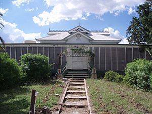
Junction of Coral and Pelican Creeks, 2009
|
|||||||||||||||
| Population | 39 (2021 census) | ||||||||||||||
| • Density | 0.02084/km2 (0.0540/sq mi) | ||||||||||||||
| Postcode(s) | 4804 | ||||||||||||||
| Area | 1,871.8 km2 (722.7 sq mi) | ||||||||||||||
| Time zone | AEST (UTC+10:00) | ||||||||||||||
| Location |
|
||||||||||||||
| LGA(s) | Whitsunday Region | ||||||||||||||
| State electorate(s) | Burdekin | ||||||||||||||
| Federal Division(s) | Capricornia | ||||||||||||||
|
|||||||||||||||
Springlands is a rural locality in the Whitsunday Region, Queensland, Australia.
In the 2021 census, Springlands had a population of 39 people.
Geography
The locality completely surrounds the localities of Collinsville and Scottville.
Springlands has the following mountains:
- Mount Bella Vista (20°33′54″S 147°40′36″E / 20.5649°S 147.6767°E) 229 metres (751 ft)
- Mount Devlin (20°31′17″S 147°50′00″E / 20.5214°S 147.8332°E) 487 metres (1,598 ft)
- Mount Jimmy (20°34′23″S 147°39′58″E / 20.5730°S 147.6660°E) 168 metres (551 ft)
- Mount Toussaint (20°29′44″S 147°48′30″E / 20.4955°S 147.8084°E) 449 metres (1,473 ft)
- Mount Vista (20°35′42″S 147°54′27″E / 20.5951°S 147.9076°E) 476 metres (1,562 ft)
- Pine Mountain (20°28′24″S 147°54′36″E / 20.4732°S 147.9101°E) 515 metres (1,690 ft)
- Sonoma Peak (20°33′52″S 147°53′49″E / 20.5645°S 147.8970°E) 391 metres (1,283 ft)
The majority of the southern boundary is aligned with the Bowen River. Sonoma State Forest covers 8,800 hectares in the north-east of Springlands (20°28′44″S 147°53′51″E / 20.4788°S 147.8976°E).
Demographics
In the 2016 census, Springlands had a population of 45 people.
In the 2021 census, Springlands had a population of 39 people.
Heritage listings
Springlands has a number of heritage-listed sites, including:
- Strathmore Homestead, Strathmore Road (20°29′54″S 147°37′48″E / 20.4982°S 147.6299°E)
Economy
The Collinsville coal mine is located in the locality (20°33′54″S 147°46′03″E / 20.5651°S 147.7676°E) extending into neighbouring Collinsville.
There are four solar farms operated by Edify in Springlands:
- Daydream Solar Farm (20°28′41″S 147°45′55″E / 20.4781°S 147.7652°E)
- Hayman Solar Farm (20°28′53″S 147°45′08″E / 20.4814°S 147.7523°E)
- Whitsunday Solar Farm (20°29′39″S 147°44′52″E / 20.4943°S 147.7479°E)
- Hamilton Solar Farm (20°30′39″S 147°45′21″E / 20.5108°S 147.7559°E)
Education
There are no schools in Springlands. The nearest government primary schools are in Collinsville State School in neighbouring Collinsville and Scotville State School in neighbouring Scotville. The nearest government secondary school is Collinsville State High School in Collinsville.


