Spitsbergen facts for kids

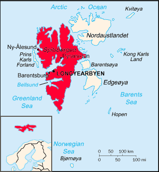
Map of the Svalbard archipelago, with Spitsbergen emphasized in solid red. Inset shows the islands' place in Northern Europe.
|
|
| Geography | |
|---|---|
| Location | Arctic Ocean |
| Coordinates | 78°45′N 16°00′E / 78.750°N 16.000°E |
| Archipelago | Svalbard |
| Area | 37,673 km2 (14,546 sq mi) |
| Area rank | 36th |
| Highest elevation | 1,717 m (5,633 ft) |
| Highest point | Newtontoppen |
| Administration | |
|
Norway
|
|
| Largest settlement | Longyearbyen |
| Demographics | |
| Population | 2,642 (2012) |
Spitsbergen (which is also spelled Spitzbergen) is the largest island of the archipelago Svalbard. It was called West Spitsbergen until 1965. The name East Spitsbergen was proposed for the third-largest island of the group, Edgeøya.
Today, it is the only island on Svalvard which is settled permanently. The island has a size of about 380 kilometres (240 mi) by 220 kilometres (140 mi)
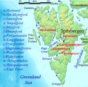
There are only few active settlements on Spitsbergen, among them
- Barentsburg, about 500 people
- Longyearbyen, main settlement, about 2.500 people
- Ny-Ålesund, scientific station, about 30-35 peolple
- Sveagruva,mining town, about 300, many commuting from Longyearbyen
There are several abandoned ones:
- Grumant, mining town, abandoned in 1965
- Colesbukta, shipping terminal for Grumant, about half-way between Grumant and Barentsburg.
- Ny-London, mining town, abandoned in the 1920s. Near Ny-Alesund
- Pyramiden, mining town, mostly abandoned in the 1990s
Images for kids
-
Abandoned mine at Longyearbyen
See also
 In Spanish: Spitsbergen para niños

All content from Kiddle encyclopedia articles (including the article images and facts) can be freely used under Attribution-ShareAlike license, unless stated otherwise. Cite this article:
Spitsbergen Facts for Kids. Kiddle Encyclopedia.


