South Road, Adelaide facts for kids
Quick facts for kids South RoadMain South Road South Australia |
|
|---|---|
 |
|
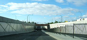
| South Road Underpass beneath the Anzac Highway | |
| General information | |
| Type | Road |
| Length | 115 km (71 mi) |
| Major junctions | |
| North end | Port River Expressway, Wingfield, Adelaide |
| Yankalilla-Victor Harbor Road | |
| direction_b = South | end_b = Cape Jervis-Noarlunga Road, Cape Jervis, South Australia
via Ferry to Kangaroo Island |coordinates_b = 35°36′25″S 138°05′35″E / 35.607°S 138.093°E | through = Croydon, Hindmarsh, Mile End, Reynella, Morphett Vale, Old Noarlunga, Aldinga, Sellicks Hill, Yankalilla }}
South Road (route A2), also known as Main South Road (routes A13 and B23), is a major north–south conduit in Adelaide and Fleurieu Peninsula in South Australia. It is one of Adelaide's most important arterial and bypass roads.
The northern part of South Road contributes the central component of the North–South Corridor, a series of road projects under construction or planning that will eventually provide a continuous expressway between Old Noarlunga and Gawler.
Images for kids


