Soda Dam Hot Spring facts for kids
Quick facts for kids Soda Dam Hot Spring |
|
|---|---|
| Soda Dam Jemez Springs Soda Dam |
|
 |
|
| Location | near the town of Jemez Springs, NM |
| Coordinates | 35°47′40″N 106°41′12″W / 35.79445°N 106.68669°W |
| Elevation | 6,332 feet |
| Type | volcanic |
| Temperature | 117° F (47° C) |
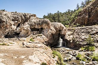
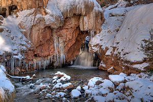
The Soda Dam Hot Spring, also known as the Jemez Springs Soda Dam or simply Soda Dam, is a grouping of fifteen hot springs which have formed a unique calcium carbonate and travertine formation creating a bridge over the Jemez River.
Contents
Geology
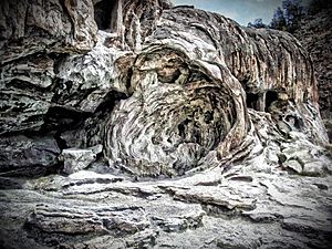
The Soda Dam was formed by calcium carbonate and travertine deposits from thermal spring water that was built up over the course of 7,000 years. The river flows through the dome-like bridge created by the deposition of these minerals across the river. There is also a waterfall at the site. It is over 300 feet long, 50 feet high, and 50 feet wide at the base.
The hot spring water is heated by volcanic magma of the Valles Caldera. The water percolates through shale and limestone, following cracks in the Jemez geological fault zone to emerge at the springs. Because algal filaments are contained within the carbonate rock, the site is used to study ways in which possible ancient life on Mars may be detected through examination of rocks.
History
The springs were used by local indigenous people before the arrival of settlers. Artifacts and archaeological finds have been discovered at Jemez Cave near Soda Dam; evidence of human use as long ago as 2,500 B.C. In the 1960s, New Mexico state highway #4 was built which involved blasting the rock to build the road. The course of the spring water changed at that time, and now most of it flows into ditches on either side of the road. Some of the springs stopped flowing entirely.
Water profile
The maximum water temperature of the spring system is 117 °F (47 °C).
Location
The geographic coordinates are N 35.79445 W 106.68669.


