Smoky Hills facts for kids
Quick facts for kids Smoky Hills |
|
|---|---|
 |
|
| Geography | |
| Country | United States |
| States | Kansas and Nebraska |
| Region | Plains Border (subregion) |
| Range coordinates | 38°47′30″N 97°59′51″W / 38.79167°N 97.99750°W |
| Parent range | Great Plains |
| Geology | |
| Age of rock | Cretaceous |
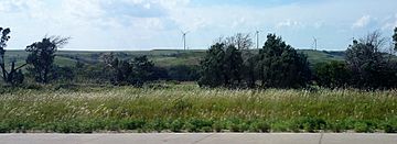
The Smoky Hills are an upland area of hills in the Great Plains are of North America. They are in the Midwestern United States, mostly in north-central Kansas and a small part of south-central Nebraska.
Geography
The Republican River, Saline River, Solomon River, and Smoky Hill River all go east through the Smoky Hills. This is because they start in the High Plains. Starting in the 1940s, the U.S. Army Corps of Engineers and the U.S. Bureau of Reclamation dammed these rivers at points in the Smoky Hills for flood control and irrigation reasons. This created many reservoirs. These include Cedar Bluff Reservoir, Kanopolis Lake, Kirwin Reservoir, Waconda Lake, Webster Reservoir, and Wilson Lake.
Land in the Smoky Hills is mostly used for farming. The region doesn't have very many people. There are cities that are small, but there are no big cities. The two biggest cities in the Smoky Hills region are Salina, Kansas and Hays, Kansas.
Images for kids
-
KDOT distance map color-coded by physiographic region showing the Smoky Hills (center)


