Simsboro, Louisiana facts for kids
Quick facts for kids
Simsboro, Louisiana
|
|
|---|---|
|
Village
|
|
| Village of Simsboro | |

JR's Place is the restaurant in Simsboro.
|
|

Location of Simsboro in Lincoln Parish, Louisiana.
|
|

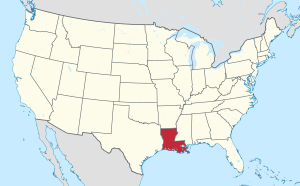
Location of Louisiana in the United States
|
|
| Country | United States |
| State | Louisiana |
| Parish | Lincoln |
| Area | |
| • Total | 3.48 sq mi (9.02 km2) |
| • Land | 3.48 sq mi (9.02 km2) |
| • Water | 0.00 sq mi (0.00 km2) |
| Elevation | 322 ft (98 m) |
| Population
(2020)
|
|
| • Total | 803 |
| • Density | 230.61/sq mi (89.04/km2) |
| Time zone | UTC-6 (CST) |
| • Summer (DST) | UTC-5 (CDT) |
| Area code(s) | 318 |
| FIPS code | 22-70630 |

Simsboro is a village in western Lincoln Parish, Louisiana, United States. The population was 841 at the 2010 census. It is part of the Ruston Micropolitan Statistical Area.
Two 20th century lawmakers who were natives of Simsboro are interred at Simsboro Cemetery: State Representatives L.D. "Buddy" Napper, who served from 1952 to 1964, and practiced law for a half-century in Ruston, and Ragan Madden, who left the House in 1949 to become the five-term district attorney of the 3rd Judicial District. A 19th Century lawmaker who lived in Simsboro was Representative George M. Lomax, who in 1894 introduced the enabling legislation, Act 68, to establish the future Louisiana Tech University.
Contents
Geography
Simsboro is located at 32°32′3″N 92°47′11″W / 32.53417°N 92.78639°W (32.534169, -92.786417).
According to the United States Census Bureau, the village has a total area of 3.5 square miles (9.1 km2), all land.
Demographics
| Historical population | |||
|---|---|---|---|
| Census | Pop. | %± | |
| 1890 | 248 | — | |
| 1910 | 282 | — | |
| 1920 | 290 | 2.8% | |
| 1960 | 363 | — | |
| 1970 | 412 | 13.5% | |
| 1980 | 553 | 34.2% | |
| 1990 | 634 | 14.6% | |
| 2000 | 684 | 7.9% | |
| 2010 | 841 | 23.0% | |
| 2020 | 803 | −4.5% | |
| U.S. Decennial Census | |||
2020 census
| Race | Number | Percentage |
|---|---|---|
| White (non-Hispanic) | 445 | 55.42% |
| Black or African American (non-Hispanic) | 269 | 33.5% |
| Native American | 5 | 0.62% |
| Other/Mixed | 30 | 3.74% |
| Hispanic or Latino | 54 | 6.72% |
As of the 2020 United States census, there were 803 people, 352 households, and 264 families residing in the village.
See also
 In Spanish: Simsboro para niños


