Silver Peak Range facts for kids
Quick facts for kids Silver Peak Range |
|
|---|---|
| Highest point | |
| Peak | Piper Peak |
| Elevation | 2,880 m (9,450 ft) |
| Geography | |
| Country | United States |
| State | Nevada |
| District | Esmeralda County |
| Range coordinates | 37°39′11.750″N 117°50′40.347″W / 37.65326389°N 117.84454083°W |
| Topo map | USGS Mohawk Mine |
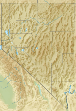
The Silver Peak Range is a mountain range in southwest Esmeralda County, Nevada, United States.
Geography
The Range forms the east and southeast side of Fish Lake Valley. The towering White Mountains lie across the valley to the west and southwest. The Palmetto Mountains are to the south.
Piper Peak, Red Mountain, and Emigrant Peak are in the range.
External Resources
- R.C. Root, Anthony & Co, "Map Of Nevada Showing New Discoveries Of Silver Peak," 1865.
Images for kids
-
Aerial view of the Silver Peak Range looking northeast across Fish Lake Valley from the Nevada-California Border.

All content from Kiddle encyclopedia articles (including the article images and facts) can be freely used under Attribution-ShareAlike license, unless stated otherwise. Cite this article:
Silver Peak Range Facts for Kids. Kiddle Encyclopedia.


