Showdown Ski Area facts for kids
Quick facts for kids Showdown Ski Area |
|
|---|---|
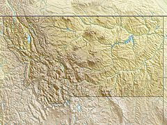
| Location | Meagher County, Montana, near Neihart, Montana |
| Nearest city | Neihart, Montana |
| Coordinates | 46°50′19″N 110°42′32″W / 46.83861°N 110.70889°W |
| Top elevation | 8,200 ft (2,500 m) |
| Base elevation | 6,800 ft (2,100 m) |
| Skiable area | 640 acres (2.6 km2) |
| Runs | 34 |
| Lift system | 4 total: One Triple, Two Double, One Conveyer |
| Snowfall | 20 feet (6.1 m) |
| Website | Showdown official website: http://www.showdownmontana.com/ |
Showdown is an alpine ski area located in the Little Belt Mountains in Central Montana, United States.
History
Created in 1936 and originally called King's Hill Ski Area, Showdown is a small-scale ski area that is often closed on Mondays and Tuesdays, receiving most patrons on the weekends during the season. An office in Great Falls, Montana has also been known to be available for ticket sales.
In 1973 the Ski Area changed its name from King's Hill Ski Area to Showdown Ski Area. In 1995, it was changed again to Showdown Montana.
Geography
The Ski Area is near Kings Hill Pass in a high elevation area of the Little Belt Mountains. One of the most difficult runs is Glory Hole and one of the easiest runs is Golden Goose.
Showdown Website.

All content from Kiddle encyclopedia articles (including the article images and facts) can be freely used under Attribution-ShareAlike license, unless stated otherwise. Cite this article:
Showdown Ski Area Facts for Kids. Kiddle Encyclopedia.


