Sherman Island (Antarctica) facts for kids
|
Location in Antarctica
|
|
| Geography | |
|---|---|
| Location | Antarctica |
| Coordinates | 72°40′S 99°45′W / 72.667°S 99.750°W |
| Area | 1,121 km2 (433 sq mi) |
| Length | 51 km (31.7 mi) |
| Width | 19 km (11.8 mi) |
| Administration | |
| Administered under the Antarctic Treaty System | |
| Demographics | |
| Population | Uninhabited |
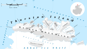
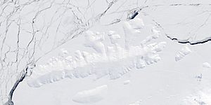
Sherman Island is an ice-covered island of Antarctica about 51 kilometres (32 mi) long and 16 kilometres (10 mi) wide, lying south of Thurston Island in the middle of Peacock Sound. The feature rises above the Abbot Ice Shelf which occupies the sound.
Delineated from aerial photographs taken by US Navy Operation Highjump in December 1946. Named by US-ACAN for Admiral Forrest Sherman, USN, Chief of Naval Operations, 1949–51, when preparations were being made for U.S. Naval support during the forthcoming International Geophysical Year (IGY) operations.
Maps
See also
 In Spanish: Isla Sherman para niños

All content from Kiddle encyclopedia articles (including the article images and facts) can be freely used under Attribution-ShareAlike license, unless stated otherwise. Cite this article:
Sherman Island (Antarctica) Facts for Kids. Kiddle Encyclopedia.


