Shadowood, Oregon facts for kids
Quick facts for kids
Shadowood, Oregon
|
|
|---|---|

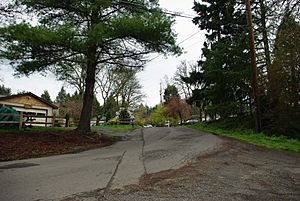
Street in the community
|
|
| Country | United States |
| State | Oregon |
| County | Clackamas |
| Elevation | 190 ft (60 m) |
| Time zone | UTC-8 (Pacific (PST)) |
| • Summer (DST) | UTC-7 (PDT) |
| ZIP code |
97068
|
| GNIS feature ID | 1136738 |
Shadowood is an unincorporated community in Clackamas County, Oregon, United States, about four miles south of Lake Oswego on the Tualatin River east of Shipley Bridge. Shadowood has a West Linn ZIP code.
The Shadowood area is a rural neighborhood comprising approximately 64 residences on both sides of a ravine formed by an unnamed creek and containing wetlands. The subdivision is served by a water system originally constructed in 1922 that started providing service in 1924.
The subdivision is named Shadow Wood Park and was originally a 1920s development of recreational retreats. The original residences were American Craftsman/Rustic-style log houses.

All content from Kiddle encyclopedia articles (including the article images and facts) can be freely used under Attribution-ShareAlike license, unless stated otherwise. Cite this article:
Shadowood, Oregon Facts for Kids. Kiddle Encyclopedia.

