Searcy County, Arkansas facts for kids
Quick facts for kids
Searcy County
|
||
|---|---|---|

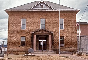
Searcy County Courthouse
|
||
|
||

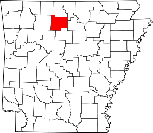
Location within the U.S. state of Arkansas
|
||
 Arkansas's location within the U.S. |
||
| Country | ||
| State | ||
| Founded | December 13, 1838 | |
| Named for | Richard Searcy | |
| Seat | Marshall | |
| Largest city | Marshall | |
| Area | ||
| • Total | 669 sq mi (1,730 km2) | |
| • Land | 666 sq mi (1,720 km2) | |
| • Water | 2.4 sq mi (6 km2) 0.4%% | |
| Population
(2020)
|
||
| • Total | 7,828 | |
| • Density | 11.701/sq mi (4.518/km2) | |
| Time zone | UTC−6 (Central) | |
| • Summer (DST) | UTC−5 (CDT) | |
| Congressional district | 1st | |
| Website | https://searcyco.org/ | |
Searcy County (/ˈsɜːrsi/ SUR-see) is a county located in the U.S. state of Arkansas. As of the 2020 census, the population was 7,828. The county seat is Marshall. The county was formed December 13, 1838, from a portion of Marion County and named for Richard Searcy, the first clerk and judge in the Arkansas Territory. The city of Searcy, Arkansas, some 70 miles away, shares the name despite having never been part of Searcy County. The county is an alcohol prohibition or dry county.
Contents
History
During the American Civil War, Searcy County, Arkansas had strong, pro-Union leanings, forming an organization known as the "Arkansas Peace Society".
Chocolate Roll Capital of the World
The Chocolate Roll is a dessert endemic to Searcy but little known outside the near region. A typical Chocolate Roll is made from pie dough spread with a mixture of cocoa powder, shortening, and sugar, then rolled up and baked. In 2012 The Greater Searcy County Chamber of Commerce declared Searcy County the "Chocolate Roll Capital of the World™", and asserted trademarks. Since 2012 Marshall High School has hosted an annual Chocolate Roll Festival that includes the World Champion Chocolate Roll Contest. The 6th was held on March 18, 2017.
Geography
According to the U.S. Census Bureau, the county has a total area of 669 square miles (1,730 km2), of which 666 square miles (1,720 km2) is land and 2.4 square miles (6.2 km2) (0.4%) is water.
Major highways
 U.S. Highway 65
 Arkansas Highway 14
 Arkansas Highway 16
 Arkansas Highway 27
 Arkansas Highway 66
 Arkansas Highway 74
 Arkansas Highway 235
 Arkansas Highway 333
 Arkansas Highway 374
 Arkansas Highway 377
Adjacent counties
- Marion County (north)
- Baxter County (northeast)
- Stone County (east)
- Van Buren County (south)
- Pope County (southwest)
- Newton County (west)
- Boone County (northwest)
National protected areas
- Buffalo National River (part)
- Ozark National Forest (part)
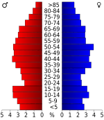
Demographics
| Historical population | |||
|---|---|---|---|
| Census | Pop. | %± | |
| 1840 | 936 | — | |
| 1850 | 1,979 | 111.4% | |
| 1860 | 5,271 | 166.3% | |
| 1870 | 5,614 | 6.5% | |
| 1880 | 7,278 | 29.6% | |
| 1890 | 9,664 | 32.8% | |
| 1900 | 11,988 | 24.0% | |
| 1910 | 14,825 | 23.7% | |
| 1920 | 14,590 | −1.6% | |
| 1930 | 11,056 | −24.2% | |
| 1940 | 11,942 | 8.0% | |
| 1950 | 10,424 | −12.7% | |
| 1960 | 8,124 | −22.1% | |
| 1970 | 7,731 | −4.8% | |
| 1980 | 8,847 | 14.4% | |
| 1990 | 7,841 | −11.4% | |
| 2000 | 8,261 | 5.4% | |
| 2010 | 8,195 | −0.8% | |
| 2020 | 7,828 | −4.5% | |
| 2023 (est.) | 7,806 | −4.7% | |
| U.S. Decennial Census 1790–1960 1900–1990 1990–2000 2010 |
|||
2020 census
| Race | Number | Percentage |
|---|---|---|
| White (non-Hispanic) | 7,092 | 90.6% |
| Black or African American (non-Hispanic) | 5 | 0.06% |
| Native American | 65 | 0.83% |
| Asian | 20 | 0.26% |
| Pacific Islander | 5 | 0.06% |
| Other/Mixed | 501 | 6.4% |
| Hispanic or Latino | 140 | 1.79% |
As of the 2020 United States census, there were 7,828 people, 3,327 households, and 2,333 families residing in the county.
Education
Public education is provided for early childhood, elementary and secondary education from multiple school districts including:
- Searcy County School District, which includes Marshall High School
- Ozark Mountain School District, which includes Searcy County-based St. Joe High School and St. Joe Elementary School.
Communities
Cities
Towns
Census-designated places
Unincorporated Communities
Townships
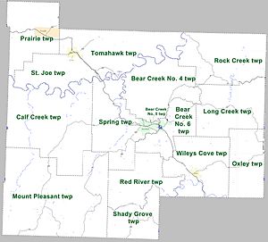
Townships in Arkansas are the divisions of a county. Each township includes unincorporated areas; some may have incorporated cities or towns within part of their boundaries. Arkansas townships have limited purposes in modern times. However, the United States Census does list Arkansas population based on townships (sometimes referred to as "county subdivisions" or "minor civil divisions"). Townships are also of value for historical purposes in terms of genealogical research. Each town or city is within one or more townships in an Arkansas county based on census maps and publications. The townships of Searcy County are listed below; listed in parentheses are the cities, towns, and/or census-designated places that are fully or partially inside the township.
| Township | FIPS code | ANSI code (GNIS ID) |
Population center(s) |
Pop. (2010) |
Pop. density (/mi2) |
Pop. density (/km2) |
Land area (mi2) |
Land area (km2) |
Water area (mi2) |
Water area (km2) |
Geographic coordinates |
|---|---|---|---|---|---|---|---|---|---|---|---|
| Bear Creek No. 4 | 05-90177 | 02406938 | Marshall | 989 | 21.20 | 8.18 | 46.655 | 120.8 | 0.174 | 0.4507 | 35°58′16″N 92°37′26″W / 35.971174°N 92.623964°W |
| Bear Creek No. 5 | 05-90178 | 02406939 | Marshall | 728 | 492.22 | 190.08 | 1.479 | 3.831 | 0.002 | 0.005180 | 35°54′35″N 92°38′47″W / 35.909629°N 92.646337°W |
| Bear Creek No. 6 | 05-90179 | 02406940 | Marshall | 913 | 36.64 | 14.15 | 24.917 | 64.53 | 0.096 | 0.2486 | 35°54′16″N 92°36′32″W / 35.904425°N 92.608797°W |
| Calf Creek | 05-90708 | 00066892 | 326 | 4.01 | 1.55 | 81.202 | 210.3 | 0.514 | 1.331 | 35°54′12″N 92°50′49″W / 35.903196°N 92.846919°W | |
| Long Creek | 05-92274 | 00069086 | 474 | 10.72 | 4.14 | 44.219 | 114.5 | 0.060 | 0.1554 | 35°55′23″N 92°29′16″W / 35.923104°N 92.487694°W | |
| Mount Pleasant | 05-90981 | 00066895 | 465 | 4.28 | 1.65 | 108.750 | 281.7 | 0.248 | 0.6423 | 35°47′22″N 92°50′34″W / 35.789412°N 92.842860°W | |
| Oxley | 05-92801 | 02407397 | 364 | 11.37 | 4.39 | 32.018 | 82.93 | 0.027 | 0.06993 | 35°52′02″N 92°27′47″W / 35.867295°N 92.463161°W | |
| Prairie | 05-93012 | 00069090 | Pindall | 550 | 13.82 | 5.34 | 39.793 | 103.1 | 0.018 | 0.04662 | 36°03′55″N 92°53′29″W / 36.065325°N 92.891250°W |
| Red River | 05-93087 | 00069091 | 321 | 9.69 | 3.78 | 33.144 | 85.84 | 0.064 | 0.1658 | 35°48′55″N 92°41′14″W / 35.815267°N 92.687262°W | |
| Rock Creek | 05-93213 | 00069093 | 547 | 10.48 | 3.99 | 52.915 | 137.0 | 0.097 | 0.2512 | 36°01′19″N 92°29′48″W / 36.021866°N 92.496667°W | |
| St. Joe | 05-93279 | 00069094 | St. Joe | 390 | 13.07 | 5.05 | 29.838 | 77.28 | 0.239 | 0.6190 | 35°59′13″N 92°51′15″W / 35.986869°N 92.854089°W |
| Shady Grove | 05-93351 | 00069095 | 189 | 4.41 | 2.87 | 42.834 | 110.9 | 0.971 | 2.515 | 35°44′37″N 92°39′19″W / 35.743664°N 92.655141°W | |
| Spring | 05-93456 | 00069096 | Marshall | 588 | 12.59 | 4.86 | 46.715 | 121.0 | 0.227 | 0.5879 | 35°54′17″N 92°42′38″W / 35.904585°N 92.710556°W |
| Tomahawk | 05-93618 | 00069098 | Gilbert, St. Joe | 574 | 10.68 | 4.12 | 53.762 | 139.2 | 0.421 | 1.090 | 36°02′13″N 92°42′57″W / 36.036902°N 92.715763°W |
| Wileys Cove | 05-94062 | 00069099 | Leslie | 777 | 17.18 | 6.63 | 45.225 | 117.1 | 0.210 | 0.5439 | 35°51′20″N 92°31′11″W / 35.855434°N 92.519860°W |
| Source: U.S. Census Bureau | |||||||||||
See also
 In Spanish: Condado de Searcy para niños


