Scheduled monuments in Greater London facts for kids
The following is a list of Scheduled monuments in Greater London.
In the United Kingdom, a scheduled monument is a "nationally important" archaeological site or historic building that has been given protection against unauthorised change by being placed on a list (or "schedule") by the Secretary of State for Digital, Culture, Media and Sport (DCMS); Historic England takes the leading role in identifying such sites. Monuments are defined in the Ancient Monuments and Archaeological Areas Act 1979 and the National Heritage Act 1983. Scheduled monuments—sometimes referred to as scheduled ancient monuments—can also be protected through listed building procedures, and Historic England considers listed building status to be a better way of protecting buildings and standing structures. A scheduled monument that is later determined to "no longer merit scheduling" can be descheduled.
| Name | Location | Borough | Date scheduled | Notes | Image | Entry number |
|---|---|---|---|---|---|---|
| Barking Abbey | 80m NNW of St Margaret's Church, Barking | Barking and Dagenham | 06-Feb-1954 | 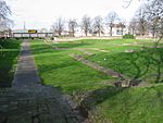 |
||
| Second World War anti-aircraft gun emplacements, Beckton | Beckton District Park South, Beckton | Newham | 18-Apr-1980 | |||
| Stratford Langthorne Abbey (part of area within precincts) | Baker's Row, West Ham | Newham | ? | |||
| Section of Roman road on Gidea Park golf course | Gidea Park Golfcourse, Gidea Park | Havering | ? | |||
| Dagnam Park Farm moated site | Dagnam Park, Harold Hill | Havering | ? | |||
| Upminster Tithe Barn | Hall Lane, Upminster | Havering | 05-Nov-1971 | Scheduled as 'Medieval grange barn, 228m south-east of Upminster Court'; now a local museum | 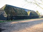 |
|
| Manor House moated site, East End Road, Finchley | East End Road, Finchley | Barnet | ? | |||
| Brockley Hill Romano-British pottery and settlement | Brockley Hill, Stanmore/Edgware | Barnet, Harrow | 25-Jan-1974 | Two non-contiguous sections on either side of Brockley Hill, along which the Barnet-Harrow border runs | 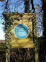 |
|
| Earthworks at Old Park | Bush Hill Park Golf Club, Grange Park | Enfield | 18-Jun-1946 | |||
| Medieval moated site, 408m ENE of Highland's School | Enfield Golf Club, Enfield Chase | Enfield | 14-Oct-1976 | |||
| Flash Road aqueduct | Whitewebbs Park, Crews Hill | Enfield | 26-Apr-1972 | |||
| Elsyng Palace | Grounds of Forty Hall, Forty Hill | Enfield | 06-Apr-1967 | |||
| Moated site, Camlet Moat, Moat Wood | Trent Park, Cockfosters | Enfield | 22-Mar-1949 | 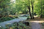 |
||
| The Curtain Playhouse | Site bounded by Hearn Street, Curtain Road and Hewett Street, Shoreditch | Hackney | 16-Aug-2019 | 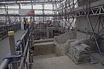 |
||
| The Theatre Playhouse | 3-5 New Inn Broadway, 5-15 New Inn Yard, 86-96 Curtain Road, Shoreditch | Hackney | 14-Sep-2016 | Site situated under modern buildings | 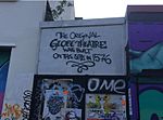 |
|
| Priory and Hospital of St Mary Spital | Norton Folgate, Spitalfield | Hackney | ? | Remains situated below street level. |  |
|
| Fulham Palace moated site | Fulham | Hammersmith & Fulham | ? | 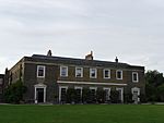 |
||
| Kensington Palace | Kensington | Kensington & Chelsea | ? |  |
||
| Pottery kiln in Walmer Road | Walmer Road, Notting Hill | Kensington & Chelsea | 15-Mar-1966 | 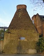 |
||
| Hall Place | Bourne Road, Bexley | Bexley | 01-May-1948 | 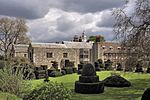 |
||
| Howbury moated site | Moat Lane, Slade Green | Bexley | 29-Jul-1960 |  |
||
| Lesnes Abbey | Abbey Road, Abbey Wood | Bexley | 04-Nov-1930 |  |
||
| Faesten Dic, a medieval frontier work in Joydens Wood | Joyden's Wood | Bexley | 14-Jan-1955 | The vast majority of this monument lies in Dartford, Kent |  |
|
| Moated site at Down Barns Farm | Sharvel Lane, Northolt | Ealing | 04-Jun-1952 |  |
||
| Hanwell flight of locks and brick boundary wall of St Bernard's Hospital | St Bernard's Hospital, Hanwell | Ealing | 24-Feb-1975 | |||
| Iron Age settlement on Horsenden Hill | Sudbury Golf Club, Sudbury | Ealing | 08-Mar-1976 |  |
||
| Medieval moated site, 454m south-west of Sudbury Golf Club House | Sudbury Golf Club, Sudbury | Ealing | 08-Dec-1976 | |||
| Northolt Manor moated site | Belvue Park, Northolt | Ealing | 08-Dec-1976 |  |
||
| Windmill Bridge | Windmill Lane Hanwell | Ealing | 26-Jan-1970 |  |
||
| Linear earthworks in Pear Wood, West of Watling Street | Pear Wood, Stanmore | Harrow | 26-Mar-1974 | |||
| Grim's Ditch: section N of Blythwood House | Pinner Green | Harrow | 11-Oct-1944 | |||
| Grim's Ditch: section extending 1500yds (1370m) NE from Oxhey Lane | Grim's Dyke Golf Club, Hatch End | Harrow | 11-Mar-1931 | |||
| Grim's Ditch: four linear sections between Uxbridge Road and Oxhey Lane | Hatch End | Harrow | 17-Feb-1955 | Made up of four non-contiguous sections | ||
| 18th century obelisk commemorating Cassivellaunus | Brockley Hill, Stanmore | Harrow | 23-Feb-1977 | |||
| Headstone Manor moated site | Headstone | Harrow | 05-Dec-1986 | The site is now occupied by the Harrow Museum | 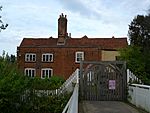 |
|
| Pinner Hill ice house | Pinner Hill Golf Club, Pinner Green | Harrow | 11-Feb-2000 | |||
| Pinner deer park, Pinner Park Farm | Headstone/Hatch End | Harrow | 09-Nov-2000 | Made of four non-contiguous sections | ||
| Kempton Park Pumping Station | Hanworth | Hounslow | 27-Nov-1981 |  |
||
| 18th century garden feature at Hanworth Park | Hanworth | Hounslow | 03-Feb-1953 | |||
| Chiswick House | Chiswick | Hounslow | ? |  |
||
| Romano-British site 1000yds (910m) W of East Bedfont parish church | Stanwell Road, East Bedfont | Hounslow | ? | |||
| Part of a causewayed enclosure, 632m north-east of Mayfield Farm | Great South-West Road, East Bedfont | Hounslow | 13-Jan-1970 | |||
| Hampton Court Palace | Hampton Wick | Richmond-upon-Thames | 01-Jan-1900 | 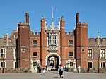 |
||
| Kew Palace (remains of) | Kew | Richmond-upon-Thames | 01-Jan-1900 |  |
||
| Old Brew House, Bushy Park | Bushy Park, Teddington | Richmond-upon-Thames | 23-Feb-1938 | 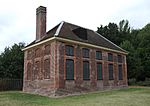 |
||
| The Shene Charterhouse | Old Deer Park, Kew | Richmond-upon-Thames | 13-Mar-2015 | |||
| Park Pale, Ruislip | Ruislip Common, Ruislip | Hillingdon | 28-Feb-2006 | |||
| Medieval moated site 382m south-east of Brackenbury Farm | West Ruislip | Hillingdon | 08-Jul-1974 |  |
||
| Ickenham Manor Farm | Ickenham | Hillingdon | 22-Mar-1949 | |||
| Ruislip motte and bailey | Ruislip | Hillingdon | 02-Aug-1934 | |||
| Brackenbury Farm moated site 3/4 mile (1210m) NW of Ickenham church | Breakspear Road South, Ickenham | Hillingdon | 27-Feb-1975 | |||
| Tudor naval storehouse at Convoy's Wharf | Deptford | Lewisham | 22-Dec-2003 | |||
| Shrewsbury Barrow, Shooters Hill | Junction of Plum Lane and Brinklow Crescent, Shooter's Hill | Greenwich | 07-Jan-2016 |  |
||
| Burial mound on Winns Common | Winn's Common, Plumstead | Greenwich | 12-Aug-1975 |  |
||
| Greenwich Observatory | Greenwich Park, Greenwich | Greenwich | ? |  |
||
| Greenwich Hospital (RN College) | Greenwich Park, Greenwich | Greenwich | ? | 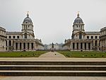 |
||
| Queen's House | Greenwich Park, Greenwich | Greenwich | ? |  |
||
| West Grove, Conduit House | Junction of West Grove and Hyde Vale, Blackheath | Greenwich | 20-Mar-1951 | 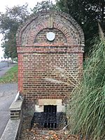 |
||
| Conduit Head, Eltham | Southend Crescent, Eltham | Greenwich | 20-Sep-1956 | |||
| Eltham Palace | Eltham | Greenwich | 09-Oct-1981 | 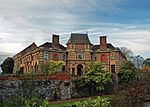 |
||
| Romano-Celtic temple in Greenwich Park | Greenwich Park, Greenwich | Greenwich | 01-Dec-2009 | 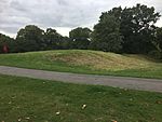 |
||
| Anglo-Saxon cemetery in Greenwich Park | Greenwich Park, Greenwich | Greenwich | 01-Dec-2009 | 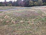 |
||
| Linear Training Fortification, Royal Military Repository | Royal Artillery Barracks, Woolwich | Greenwich | 01-Nov-2010 | Not accessible to the public. | ||
| Greenwich Palace | Greenwich Park, Greenwich | Greenwich | 22-Mar-2013 |  |
||
| Scadbury Manor moated site and fishponds | Scadbury Park, Chislehurst | Bromley | 22-Nov-2013 | 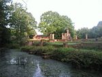 |
||
| Romano-British masonry building and Saxon cemetery, Fordcroft | Bellefield Road, St Mary Cray | Bromley | 05-Oct-1979 | |||
| Romano-British site, Wickham Court Farm | West Wickham | Bromley | 25-Jul-1978 |  |
||
| Crofton Roman Villa | Crofton Road, Orpington | Bromley | 30-Jul-1973 | Scheduled as Orpington Roman Villa |  |
|
| Camp on Keston Common | Keston Common, Keston | Bromley | 23-Aug-1934 |  |
||
| Holwood camp | South Park, Keston | Bromley | 22-Dec-1935 | Traditionally known as Caesar's Camp | ||
| Iron Age settlement and Roman villa at Warbank | Jackass Lane, Keston | Bromley | ? | Not accessible to the public. |  |
|
| High Elms ice house 130m south of Flint Lodge | Whitelands Wood, Green Street Green | Bromley | 03-Jul-2000 | |||
| Ruxley old church | Maidstone Road, Ruxley | Bromley | 24-Jan-1951 |  |
||
| Benedictine nunnery of St Mary, Clerkenwell | St James's Church, Clerkenwell | Islington | ? | The remains lies under the church grounds |  |
|
| Bell Barrow called Boadicea's Grave, 650m west of Millfield Cottage | Hampstead Heath | Camden | 12-Jan-1965 | |||
| A subterranean commercial ice-well (City of Westminster), Park Crescent West | Park Crescent, Regent's Park | Westminster | 28-Oct-2015 | |||
| The Chapter House and Pyx Chamber in the abbey cloisters, Westminster Abbey | Westminster Abbey, Westminster | Westminster | 01-Jan-1900 |  |
||
| Jewel Tower | Abingdon Street, Westminster | Westminster | 01-Jan-1900 | 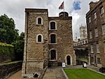 |
||
| Caesar's Camp, Wimbledon Common | Wimbledon Common, Wimbledon | Merton | 29-Nov-1932 |  |
||
| Morden Park Mound | Morden Park, Morden | Merton | 13-Apr-1949 |  |
||
| The Augustinian Priory of St Mary at Merton | Merantun Way, Merton | Merton | 17-Jan-1980 | Located in a subway under the road, though generally not open to the public. | 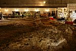 |
|
| Late Bronze Age enclosure at Queen Mary's Hospital | Carshalton | Sutton | 28-Apr-1988 | |||
| Roman villa E of Beddington Park | Beddington Lane, Beddington | Sutton | 30-Jun-1972 | Site heavily overgrown and not accessible to the public. | 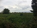 |
|
| Milestone in Sutton High Street | Sutton High Street, Sutton | Sutton | 17-Sep-1974 | 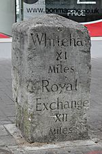 |
||
| Milestone outside No. 135 Cheam Road | Cheam Road, Cheam | Sutton | 17-Sep-1974 |  |
||
| Milestone in Brighton Road | Brighton Road, Benhilton | Sutton | 17-Sep-1974 |  |
||
| Dovecote, Beddington Park | Beddington | Sutton | 10-Jan-1952 | 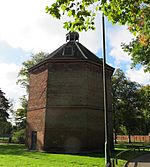 |
||
| Newe (or Wide) Ditch, Riddlesdown | Downs Court Road, Riddlesdown | Croydon | ? | |||
| Elmers End moated site | South Norwood Country Park | Croydon | 04-Nov-1975 | Heavily overgrown. | 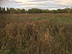 |
|
| St John the Baptist's Church gateway | Howley Road, Croydon | Croydon | 27-May-1974 |  |
||
| Croham Hurst round barrow | Croham Hurst, South Croydon | Croydon | 12-Jun-1951 |  |
||
| Regular aggregate field system, associated trackway and Anglo-Saxon barrow field on Farthing Down | Farthing Down | Croydon | 29-Nov-1932 | |||
| Bonner Hall Bridge, Regent's Canal | Bethnal Green | Tower Hamlets | 26-Jan-1976 |  |
||
| Three Colt Bridge, Gunmaker's Lane | Old Ford | Tower Hamlets | 25-Aug-1976 |  |
||
| Parnell Road Bridge | Old Ford | Tower Hamlets | 25-Aug-1976 | |||
| Tower Hill West | Petty Wales/Tower Hill Terrace | City of London, Tower Hamlets | 30-Aug-1985 | |||
| Tower of London | Whitechapel | Tower Hamlets | 01-Jan-1900 |  |
||
| London Wall: section from underground railway to Tower Hill | Tower Hill | Tower Hamlets | ? |  |
||
| Site of the launch ways of the SS Great Eastern | Land between Burrells Wharf and Bering Square, Millwall | Tower Hamlets | 31-Jul-2015 | 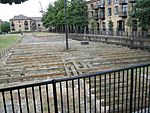 |
||
| Roman Bath House, Shadwell | Wapping Lane, Shadwell | Tower Hamlets | 05-Jun-2019 | |||
| London Wall: remains of medieval and Roman wall extending 75yds (68m) N from Trinity Place to railway | Crescent, City of London | City of London, Tower Hamlets | ? | 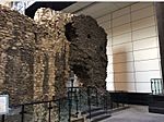 |
||
| The Hope Playhouse, and the remains of three further bear gardens, Bankside | Bear Gardens, Southwark | Southwark | 20-Sep-2016 | Two non-contiguous segments. | ||
| Roman riverboat, 136m west of Greenwood Theatre | Guy's Hospital, Southwark | Southwark | 10-Jun-1983 | |||
| Medieval moated manor house, 43m west of Cathay House | Cathay Street, Bermondsey | Southwark | 26-May-1988 | |||
| Abbey buildings | Bermondsey | Southwark | ? | 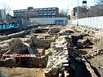 |
||
| Remains of Winchester Palace, Clink Street and waterfront | Clink Street, Southwark | Southwark | 08-May-1951 | 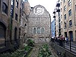 |
||
| Pumping engine house for Brunel's Thames tunnel | Rotherhithe | Southwark | 14-Dec-1976 | 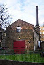 |
||
| The Rose Theatre, Rose Court | Rose Alley, Southwark | Southwark | 28-Feb-1992 | |||
| The Globe Theatre | Old Theatre Square, Southwark | Southwark | 13-Dec-1989 | 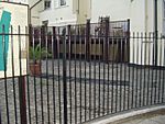 |
||
| Romano-British bath house and medieval remains at 11-15 Borough High Street | Borough High Street, Southwark | Southwark | 31-Mar-2015 | Remains under street level. | ||
| Ivy Conduit, Coombe | Coombe | Kingston upon Thames | ? | |||
| Brick reservoir 300yds (270m) SW of Gallows Conduit | Coombe | Kingston upon Thames | 15-Mar-1966 | |||
| Clattern Bridge | Kingston upon Thames | Kingston upon Thames | 16-Feb-1938 |  |
||
| Gallows Conduit, Coombe | Coombe | Kingston upon Thames | ? | Consists of two non-contiguous sections. | ||
| Coombe Conduit | Coombe West Lane, Coombe | Kingston upon Thames | ? | |||
| Castle Hill earthwork | Horton Country Park, Chessington | Kingston upon Thames | 30-Nov-1925 | |||
| Surrey Iron Railway embankment, approximately 130m south west of Lion Green Road | Lion Green Lane, Coulsdon | Croydon | 27-Jul-2009 | |||
| Group of four World War II fighter pens at the former airfield of RAF Kenley | RAF Kenley, Kenley | Croydon | 06-Sep-2004 | |||
| Group of seven World War II fighter pens at the former airfield of RAF Kenley | RAF Kenley, Kenley | Croydon | 06-Sep-2004 |  |
||
| Baynard's Castle | White Lion Hill | City of London | 16-Jun-1976 | Remains lie under the modern Baynard House. |  |
|
| Remains of St Pancras Church | Pancras Lane | City of London | 08-Jan-1979 | Site marked with blue plaque. |  |
|
| Huggin Hill Roman bath house | Huggin Hill | City of London | 06-Jun-1986 | |||
| Structures of archaeological interest below Billingsgate Market | Lower Thames Street | City of London | 20-Dec-1973 | Remains below ground. | 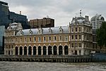 |
|
| Queenhithe dock | Queenhithe | City of London | 18-Oct-1973 |  |
||
| Smiths' Wharf | Queenhithe | City of London | 20-Nov-1973 | |||
| Roman governor's palace (site of) | Below Cannon Street Station | City of London | ? |  |
||
| Site of The London Greyfriars | Newgate Street | City of London | 22-Oct-1974 |  |
||
| Goldsmiths' Hall | Junction of Foster Lane and Gresham Street | City of London | 07-Jan-1972 |  |
||
| Innholders' Hall | College Street | City of London | 07-Jan-1952 | 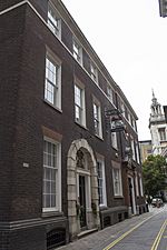 |
||
| Merchant Taylors' Hall | Threadneedle Street | City of London | 01-May-1952 |  |
||
| Painter Stainers' Hall | Little Trinity Lane | City of London | 01-May-1952 | 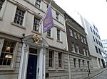 |
||
| Skinners' Hall | Dowgate Hill | City of London | 07-Jan-1952 |  |
||
| Tallow Chandlers' Hall | Dowgate Hill | City of London | 07-Jan-1952 | 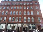 |
||
| Vintners' Hall | Vintners Place, Upper Thames Street | City of London | 06-Sep-1952 |  |
||
| Watermen's Hall | St Mary at Hill | City of London | 07-Jan-1952 | 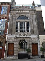 |
||
| Roman wall in basement of 90 Gracechurch Street | Nicholson and Griffin hairdressers, Gracechurch Street | City of London | ? | Located behind a screen in a basement hairdressers. |  |
|
| London Wall: remains of Roman wall, bastions and city gate of Aldgate from 17 Bevis Marks to India Street | Bevis Marks, Aldgate, Jewry Street | City of London | 21-Dec-1976 | Three non-contiguous sections located below street level. One section is visible basemen, however this is not generally open to the public. | ||
| London Wall: remains of Roman wall and bastion, Goring Street | Goring Street | City of London | ? | Remains below ground. | ||
| Barnard's Inn Hall (Mercers' School) | Holborn | City of London | 19-Feb-1951 | 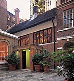 |
||
| The Monument | Monument Street | City of London | 19-Feb-1951 |  |
||
| Inner Temple Hall Buttery | Elm Court | City of London | 19-Feb-1951 | 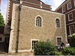 |
||
| London Wall: section bounding All Hallows Churchyard | All Hallows-on-the-Wall, London Wall | City of London | ? |  |
||
| London Wall: section in Amen Court | Amen Court | City of London | ? | |||
| London Wall: remains of Roman wall and bastion (4a) at Crutched Friars | Crutched Friars | City of London | 29-May-1952 | Located in basement of overlaying building - not accessible to the public. | ||
| London Wall: site of Newgate and 121-124 Newgate Street, remains of Roman and medieval wall, gateway and bastion | Newgate Street | City of London | ? | Two non-contiguous sections - one below ground, the other located in the reception at BOA Merrill Lynch. | 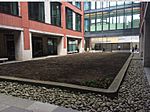 |
|
| Roman hypocaust and building on site of Coal Exchange | St Mary Court, Lower Thames Street | City of London | 07-Jan-1952 | 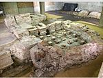 |
||
| London Wall: remains of Roman wall and bastion, Camomile Street | Camomile Street | City of London | ? | Remains below street level. | ||
| Stationers' Hall | Stationers' Hall Court | City of London | 07-Jan-1952 |  |
||
| Roman amphitheatre | Guildhall Yard | City of London | 23-Jul-1990 | 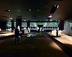 |
||
| London Wall: remains of Roman and medieval wall from W end of All Hallows Church to 38 Camomile Street | London Wall, Wormwood Street, Camomile Street | City of London | ? | Remains below street level. | ||
| London Wall: remains of Roman wall and conduit and medieval postern, Bloomfield House to site of Moor Gate | London Wall | City of London | ? | Remains below ground. Marked by plaque and information board. |  |
|
| Remains of Roman and medieval wall and gateway W of boundary of Stationers' Hall to Ludgate Hill | Amen Court, Ludgate Hill | City of London | ? | Remains below street level. Marked by plaque. |  |
|
| London Wall: remains of Roman fort wall and east gate under Aldermanbury | Aldermanbury | City of London | ? | Two non-contiguous sections. No above-ground remains. | ||
| Apothecaries' Hall | Blackfriars Lane | City of London | 07-Jan-1952 | 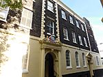 |
||
| Armourers' and Brasiers' Hall | Coleman Street | City of London | 07-Jan-1952 | 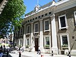 |
||
| Dyers' Hall | Dowgate Hill | City of London | 07-Jan-1952 | 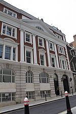 |
||
| Fishmongers' Hall | London Bridge | City of London | 07-Jan-1952 |  |
||
| London Wall: section of Roman wall and Roman, medieval and post-medieval gateway at Aldersgate | Aldersgate Street | City of London | 27-Apr-1976 | No above ground remains. | ||
| London Wall: section of Roman wall and medieval bastion in Postman's Park and King Edward Street | King Edward Street | City of London | 09-May-1974 | |||
| London Wall: section of Roman wall at the Central Criminal Court, Old Bailey | Old Bailey | City of London | 09-May-1974 | Inside basement at the Old Bailey - not generally accessible to the public. | ||
| London Wall: section of Roman wall within the London Wall underground car park, 25m north of Austral House and 55m north west of Coleman Street | London Wall | City of London | 24-Aug-1974 | Located in a below-ground car park. | 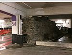 |
|
| London Wall: section of Roman and medieval wall at St Alphage Garden, incorporating remains of St Alphage's Church | St Alphage Garden | City of London | 19-Feb-1951 | 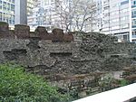 |
||
| London Wall: site of the Roman and medieval gateway of Cripple Gate | Wood Street | City of London | 26-Oct-1973 | No above ground remains. Site marked by plaque and information board. | 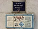 |
|
| London Wall: section of Roman and medieval wall and bastions, west and north of Monkwell Square | Monkwell Square | City of London | 20-Mar-1951 |  |
||
| London Wall: the west gate of Cripplegate fort and a section of Roman wall in London Wall underground car park, adjacent to Noble Street | London Wall | City of London | 24-Aug-1961 | No above ground remains. | ||
| London Wall: section of Roman and medieval wall and bastion at Noble Street | Noble Street | City of London | 28-Nov-2006 |  |
||
| London Wall: section of Roman wall and bastion beneath Crosswall, No. 1 America Square and Fenchurch Street railway station | Crosswall/America Square | City of London | 07-Mar-2016 | Located in a basement in an adjacent building - not accessible to the public. | ||
| Isleworth Pottery | Nazareth House, Richmond Road, Isleworth | Hounslow | 09-Dec-2016 |

