Sawtooth Range (Nunavut) facts for kids
Quick facts for kids Sawtooth Range |
|
|---|---|

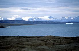
Sawtooth Range; in front: Slidre Fiord and Fosheim Peninsula
|
|
| Geography | |
| Country | Canada |
| State/Province | Nunavut |
| Range coordinates | 79°35′00″N 83°15′00″W / 79.5833°N 83.25°W |
| Parent range | Arctic Cordillera |
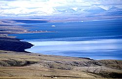
The Sawtooth Range is a jagged snow-capped mountain range on central Ellesmere Island, Nunavut, Canada. It lies between the Fosheim Peninsula and the Wolf Valley. The Sawtooth Range is a subrange of the Arctic Cordillera. It also runs through a Canadian Forces Station, called Eureka, a base used to study atmospheric changes.
Geology
Widespread clastic deposits, 80–1,800 m (260–5,910 ft) long, on the eastern side of the Sawtooth Range are the result of debris flows and slushflows.

All content from Kiddle encyclopedia articles (including the article images and facts) can be freely used under Attribution-ShareAlike license, unless stated otherwise. Cite this article:
Sawtooth Range (Nunavut) Facts for Kids. Kiddle Encyclopedia.
