Sanderston, South Australia facts for kids
Quick facts for kids SanderstonSouth Australia |
|||||||||||||||
|---|---|---|---|---|---|---|---|---|---|---|---|---|---|---|---|

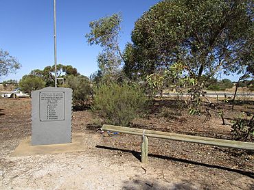
Memorial in a reserve on the corner of Angas Valley Road and Sanderston Road
|
|||||||||||||||
| Postcode(s) | 5237 | ||||||||||||||
| Elevation | 154 m (505 ft) | ||||||||||||||
| Location |
|
||||||||||||||
| LGA(s) | Mid Murray Council | ||||||||||||||
| State electorate(s) | Electoral district of Schubert | ||||||||||||||
| Federal Division(s) | Division of Barker | ||||||||||||||
|
|||||||||||||||
Sanderston is a settlement in South Australia. It is at the foot of the eastern slopes of the Mount Lofty Ranges.
The Baptist church building opened in 1905 but is now closed. The town once also had a store and post office.
Sanderston was located on the Sedan railway line until it was shortened to Apamurra in 1987.

All content from Kiddle encyclopedia articles (including the article images and facts) can be freely used under Attribution-ShareAlike license, unless stated otherwise. Cite this article:
Sanderston, South Australia Facts for Kids. Kiddle Encyclopedia.

