Saint Martin facts for kids
|
Nickname: The Friendly Island
|
|
|---|---|
 |
|
 |
|
| Geography | |
| Location | Caribbean Sea |
| Coordinates | 18°04′N 63°03′W / 18.067°N 63.050°W |
| Archipelago | Leeward Islands, Lesser Antilles, West Indies islands |
| Area | 87 km2 (34 sq mi) |
| Highest elevation | 414 m (1,358 ft) |
| Highest point | Pic Paradis |
| Administration | |
|
French Republic (France)
|
|
| Overseas collectivity | Saint Martin |
| Capital and largest settlement | Marigot (pop. 5,700) |
| Area covered | 53 km2 (20 sq mi; 60.9%) |
| Constituent country | Sint Maarten |
| Capital | Philipsburg |
| Largest settlement | Lower Prince's Quarter (pop. 8,123) |
| Area covered | 34 km2 (13 sq mi; 39.1%) |
| Demographics | |
| Demonym | St. Martinois (French); St. Maartener (Dutch) |
| Population | 77,741 (1 January 2009) |
| Pop. density | 892 /km2 (2,310 /sq mi) |
| Ethnic groups | Afro-Caribbean, European, Chinese, East Indian, and mixed |
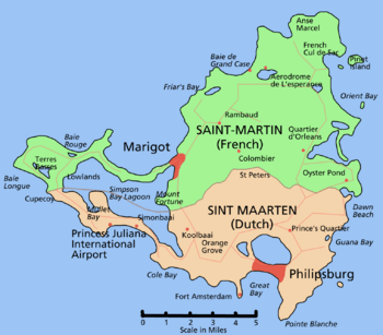
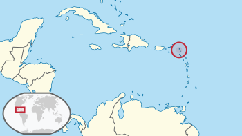
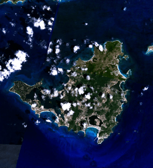
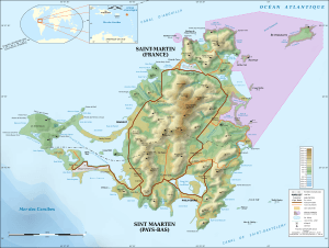
Saint Martin is a tropical island in the northeast Caribbean, approximately 300 km southeast of Puerto Rico. The 87 km² island is divided roughly in half between France and the Netherlands; it is the smallest inhabited sea island divided between two nations.
- The southern Dutch half comprises the Eilandgebied Sint Maarten (Island area of St. Martin) was part of the Netherlands Antilles, until the Antilles was dissolved in October 2010, when Sint Maarten became a "country" ("land") within the Kingdom of the Netherlands. The Government of the Netherlands responsible for defence, foreign affairs and nationality law. Although part of the Kingdom of the Netherlands the territory of Sin Maarten is not part of the European Union although its citizens are Citizens of the European Union
- The northern French half comprises the Collectivité de Saint-Martin (Collectivity of St. Martin) and is a overseas territory of France.
The main towns are Marigot (on the French part) and Philipsburg in the Dutch one. About 60.000 people live on the island.
Images for kids
-
Simpson Bay, Sint Maarten, Dutch side
-
Marigot, Saint Martin, French side

All content from Kiddle encyclopedia articles (including the article images and facts) can be freely used under Attribution-ShareAlike license, unless stated otherwise. Cite this article:
Saint Martin Facts for Kids. Kiddle Encyclopedia.


