
Saco, Montana facts for kids
Quick facts for kids
Saco, Montana
|
|
|---|---|

Downtown Saco
|
|

Location of Saco, Montana
|
|
| Country | United States |
| State | Montana |
| County | Phillips |
| Area | |
| • Total | 0.30 sq mi (0.79 km2) |
| • Land | 0.30 sq mi (0.79 km2) |
| • Water | 0.00 sq mi (0.00 km2) |
| Elevation | 2,182 ft (665 m) |
| Population
(2020)
|
|
| • Total | 159 |
| • Density | 523.03/sq mi (201.97/km2) |
| Time zone | UTC-7 (Mountain (MST)) |
| • Summer (DST) | UTC-6 (MDT) |
| ZIP code |
59261
|
| Area code(s) | 406 |
| FIPS code | 30-65050 |
| GNIS feature ID | 2412590 |
Saco is a town in Phillips County, Montana, United States. The population was 159 at the 2020 census.
Contents
Geography
According to the United States Census Bureau, the town has a total area of 0.33 square miles (0.85 km2), all land.
Climate
According to the Köppen Climate Classification system, Saco has a semi-arid climate, abbreviated "BSk" on climate maps.
| Climate data for Saco, Montana, 1991–2020 normals, extremes 1966–present | |||||||||||||
|---|---|---|---|---|---|---|---|---|---|---|---|---|---|
| Month | Jan | Feb | Mar | Apr | May | Jun | Jul | Aug | Sep | Oct | Nov | Dec | Year |
| Record high °F (°C) | 62 (17) |
72 (22) |
79 (26) |
92 (33) |
100 (38) |
104 (40) |
104 (40) |
105 (41) |
100 (38) |
89 (32) |
78 (26) |
67 (19) |
105 (41) |
| Mean maximum °F (°C) | 48.5 (9.2) |
51.2 (10.7) |
66.0 (18.9) |
79.6 (26.4) |
85.6 (29.8) |
91.3 (32.9) |
95.5 (35.3) |
96.2 (35.7) |
91.1 (32.8) |
80.3 (26.8) |
64.1 (17.8) |
48.9 (9.4) |
98.1 (36.7) |
| Mean daily maximum °F (°C) | 25.6 (−3.6) |
30.1 (−1.1) |
42.8 (6.0) |
57.3 (14.1) |
67.5 (19.7) |
74.3 (23.5) |
82.8 (28.2) |
82.1 (27.8) |
71.5 (21.9) |
57.2 (14.0) |
40.8 (4.9) |
29.0 (−1.7) |
55.1 (12.8) |
| Daily mean °F (°C) | 13.6 (−10.2) |
17.8 (−7.9) |
30.1 (−1.1) |
43.2 (6.2) |
53.7 (12.1) |
62.3 (16.8) |
69.0 (20.6) |
67.6 (19.8) |
56.9 (13.8) |
43.4 (6.3) |
28.7 (−1.8) |
17.4 (−8.1) |
42.0 (5.5) |
| Mean daily minimum °F (°C) | 1.5 (−16.9) |
5.5 (−14.7) |
17.4 (−8.1) |
29.1 (−1.6) |
39.9 (4.4) |
50.4 (10.2) |
55.2 (12.9) |
53.1 (11.7) |
42.3 (5.7) |
29.7 (−1.3) |
16.6 (−8.6) |
5.9 (−14.5) |
28.9 (−1.7) |
| Mean minimum °F (°C) | −27.4 (−33.0) |
−19.5 (−28.6) |
−6.3 (−21.3) |
14.1 (−9.9) |
25.8 (−3.4) |
39.6 (4.2) |
45.6 (7.6) |
41.1 (5.1) |
28.7 (−1.8) |
13.7 (−10.2) |
−5.7 (−20.9) |
−19.4 (−28.6) |
−33.3 (−36.3) |
| Record low °F (°C) | −51 (−46) |
−45 (−43) |
−34 (−37) |
−5 (−21) |
14 (−10) |
28 (−2) |
34 (1) |
31 (−1) |
17 (−8) |
−9 (−23) |
−37 (−38) |
−48 (−44) |
−51 (−46) |
| Average precipitation inches (mm) | 0.26 (6.6) |
0.33 (8.4) |
0.53 (13) |
1.05 (27) |
1.77 (45) |
3.01 (76) |
1.69 (43) |
1.35 (34) |
1.35 (34) |
1.05 (27) |
0.54 (14) |
0.43 (11) |
13.36 (339) |
| Average snowfall inches (cm) | 4.3 (11) |
4.9 (12) |
7.0 (18) |
2.3 (5.8) |
0.4 (1.0) |
0.0 (0.0) |
0.0 (0.0) |
0.0 (0.0) |
0.0 (0.0) |
0.0 (0.0) |
0.5 (1.3) |
2.3 (5.8) |
4.9 (12) |
| Average extreme snow depth inches (cm) | 6.6 (17) |
6.5 (17) |
4.5 (11) |
1.8 (4.6) |
0.6 (1.5) |
0.0 (0.0) |
0.0 (0.0) |
0.0 (0.0) |
0.0 (0.0) |
1.0 (2.5) |
2.8 (7.1) |
5.7 (14) |
9.0 (23) |
| Average precipitation days (≥ 0.01 in) | 3.7 | 3.2 | 3.5 | 5.4 | 7.1 | 9.6 | 6.6 | 5.0 | 5.1 | 3.9 | 3.4 | 3.8 | 60.3 |
| Average snowy days (≥ 0.1 in) | 3.2 | 3.6 | 1.2 | 0.3 | 0.0 | 0.0 | 0.0 | 0.0 | 0.0 | 0.2 | 1.2 | 3.2 | 12.9 |
| Source 1: NOAA | |||||||||||||
| Source 2: National Weather Service | |||||||||||||
History
Faced with the task of naming hundreds of station stops along the High Line, Great Northern Railway officials resorted to "globe trotting." According to one story, an official spun a globe and put his finger on Saco, Maine, thus giving the town its name. Another story tells that the name is a contraction of "Sacajawea." For two years, Saco boasted the Guinness world record for making the world's largest hamburger, building the 6,040-pound burger from the beef of 17 cattle in 1999.
Demographics
| Historical population | |||
|---|---|---|---|
| Census | Pop. | %± | |
| 1920 | 425 | — | |
| 1930 | 506 | 19.1% | |
| 1940 | 452 | −10.7% | |
| 1950 | 539 | 19.2% | |
| 1960 | 490 | −9.1% | |
| 1970 | 356 | −27.3% | |
| 1980 | 252 | −29.2% | |
| 1990 | 261 | 3.6% | |
| 2000 | 224 | −14.2% | |
| 2010 | 197 | −12.1% | |
| 2020 | 159 | −19.3% | |
| U.S. Decennial Census | |||
2010 census
As of the census of 2010, there were 197 people, 102 households, and 47 families residing in the town. The population density was 597.0 inhabitants per square mile (230.5/km2). There were 127 housing units at an average density of 384.8 per square mile (148.6/km2). The racial makeup of the town was 94.4% White, 1.0% Asian, and 4.6% from two or more races. Hispanic or Latino of any race were 0.5% of the population.
There were 102 households, of which 24.5% had children under the age of 18 living with them, 39.2% were married couples living together, 4.9% had a female householder with no husband present, 2.0% had a male householder with no wife present, and 53.9% were non-families. 47.1% of all households were made up of individuals, and 23.6% had someone living alone who was 65 years of age or older. The average household size was 1.93 and the average family size was 2.83.
The median age in the town was 48.1 years. 21.3% of residents were under the age of 18; 2.1% were between the ages of 18 and 24; 22.4% were from 25 to 44; 33% were from 45 to 64; and 21.3% were 65 years of age or older. The gender makeup of the town was 50.3% male and 49.7% female.
Education
Saco School District educates students from kindergarten through 12th grade. Saco High School's team name is the Panthers.
Phillips County Library has a branch location in Saco.
Media
The Phillips County News is a weekly local newspaper. They provide a printed paper as well as news online.
Transportation
Amtrak’s Empire Builder, which operates between Seattle/Portland and Chicago, passes through the town on BNSF tracks, but makes no stop. The nearest station is located in Malta, 28 miles (45 km) to the west.
Notable people
- Wayne Stahl, Montana Legislature member
Images for kids
-

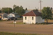
Saco Mercantile
-
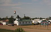
Church and water tower in Saco
-
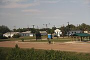
Park
-
Chet Huntley School in Saco
-

Water Tower overlooks downtown Saco
-

The sign for Saco looking east at U.S. Route 2
_-_Phillips_County,_Montana.png)


See also
 In Spanish: Saco (Montana) para niños
