Saaremaa facts for kids

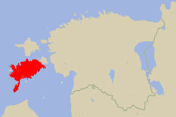
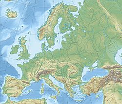
Location of Saaremaa in Estonia
|
|
| Geography | |
|---|---|
| Location | Baltic Sea |
| Coordinates | 58°25′N 22°30′E / 58.417°N 22.500°E |
| Archipelago | West Estonian archipelago |
| Area | 2,673 km2 (1,032 sq mi) |
| Administration | |
| County | Saare County |
| Demographics | |
| Population | 31,357 (31 January 2017) |
| Pop. density | 11.7 /km2 (30.3 /sq mi) |
Saaremaa is the largest island in Estonia. It is 2,673 km2 (1,032 sq mi). The island is in the Baltic Sea, south of Hiiumaa island and west of Muhu island. It belongs to the West Estonian Archipelago.
The highest point on Saaremaa is 54 m above sea level. One feature found on the island is the Kaali crater. The island has lots of forested land. One of the symbols of the island is the juniper.
Images for kids
-
Shore of Saaremaa, by Estonian artist Konrad Mägi (1913–1914).
-
The nearly circular main Kaali meteorite crater
See also
 In Spanish: Saaremaa para niños

All content from Kiddle encyclopedia articles (including the article images and facts) can be freely used under Attribution-ShareAlike license, unless stated otherwise. Cite this article:
Saaremaa Facts for Kids. Kiddle Encyclopedia.


