Saalfeld-Rudolstadt Rural District facts for kids
Quick facts for kids
Landkreis Saalfeld-Rudolstadt
|
|
|---|---|
 |
|
| Country | |
| State | Thuringia |
| Capital | Saalfeld |
| Area | |
| • Total | 1,035 km2 (400 sq mi) |
| Population
(2002)
|
|
| • Total | 129,610 |
| • Density | 125.23/km2 (324.34/sq mi) |
| Time zone | UTC+1 (CET) |
| • Summer (DST) | UTC+2 (CEST) |
| Vehicle registration | SLF |
| Website | http://www.sa-ru.de |
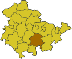
Saalfeld-Rudolstadt is a Landkreis (district) in the south of Thuringia, Germany.
History
The district dates back to the Landratsamt Saalfeld, which was created in 1868, and in 1922 it was converted into the Landkreis. Also in 1922 the district Rudolstadt was created. Both districts were merged in the local government changes of 1994.
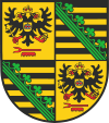
Coat of arms
Towns and municipalities
| Verwaltungsgemeinschaft-free towns | and municipalities | |
|---|---|---|
|
|
|
| Verwaltungsgemeinschaften | ||
|---|---|---|
|
1. Bergbahnregion/Schwarzatal
2. Lichtetal am Rennsteig
|
3. Mittleres Schwarzatal
|
4. Probstzella-Lehesten-Marktgölitz
|
| 1seat of the Verwaltungsgemeinschaft;2town | ||

All content from Kiddle encyclopedia articles (including the article images and facts) can be freely used under Attribution-ShareAlike license, unless stated otherwise. Cite this article:
Saalfeld-Rudolstadt Rural District Facts for Kids. Kiddle Encyclopedia.

