Rumford, South Dakota facts for kids
Quick facts for kids
Rumford, South Dakota
|
|
|---|---|
| Country | United States |
| State | South Dakota |
| County | Fall River |
| Elevation | 3,517 ft (1,072 m) |
| Time zone | UTC-7 (Mountain (MST)) |
| • Summer (DST) | UTC-6 (MDT) |
| Area code(s) | 605 |
| FIPS code | 46-56700 |
| GNIS feature ID | 1262342 |
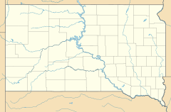
Rumford is an unincorporated community in Fall River County, South Dakota, United States. It is located on South Dakota Highway 471, 19 miles (31 km) southeast of Edgemont. Rumford is not tracked by the Census Bureau and shares a ZIP code (57735) with Edgemont and other surrounding towns and rural areas.
Rumford was founded in 1889 when Burlington Northern extended the railroad line and built a station at this location. The railroad company changed the name from Siding No. 5 to Rumford in 1894.

All content from Kiddle encyclopedia articles (including the article images and facts) can be freely used under Attribution-ShareAlike license, unless stated otherwise. Cite this article:
Rumford, South Dakota Facts for Kids. Kiddle Encyclopedia.


