Rosette, Utah facts for kids
Quick facts for kids
Rosette, Utah
|
|
|---|---|
| Country | United States |
| State | Utah |
| County | Box Elder |
| Named for | Wild roses |
| Elevation | 5,686 ft (1,733 m) |
| Time zone | UTC-7 (Mountain (MST)) |
| • Summer (DST) | UTC-6 (MDT) |
| ZIP codes |
84329
|
| Area code(s) | 435 |
| GNIS feature ID | 1445146 |
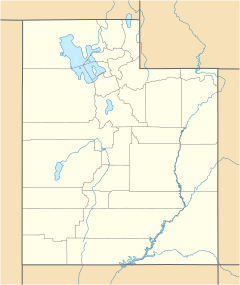
Rosette is an unincorporated ranching community in northwestern Box Elder County, Utah, United States.
| Historical population | |||
|---|---|---|---|
| Census | Pop. | %± | |
| 1920 | 100 | — | |
| 1930 | 77 | −23.0% | |
| 1940 | 86 | 11.7% | |
| 1950 | 68 | −20.9% | |
| Source: U.S. Census Bureau | |||
Description
Rosette is located about 4 miles (6.4 km) west of Park Valley, south of the Raft River Mountains.
The community was named by the town's first postmaster, Jonathan Campbell, in 1871. The name refers to the wild roses in the area.
Climate
According to the Köppen Climate Classification system, Rosette has a semi-arid climate, abbreviated "BSk" on climate maps.
| Climate data for Rosette, Utah, 1991–2020 normals, extremes 1990–present | |||||||||||||
|---|---|---|---|---|---|---|---|---|---|---|---|---|---|
| Month | Jan | Feb | Mar | Apr | May | Jun | Jul | Aug | Sep | Oct | Nov | Dec | Year |
| Record high °F (°C) | 55 (13) |
62 (17) |
74 (23) |
83 (28) |
90 (32) |
100 (38) |
102 (39) |
100 (38) |
97 (36) |
92 (33) |
69 (21) |
63 (17) |
102 (39) |
| Mean maximum °F (°C) | 46.5 (8.1) |
52.3 (11.3) |
62.9 (17.2) |
73.0 (22.8) |
80.8 (27.1) |
89.1 (31.7) |
95.1 (35.1) |
93.5 (34.2) |
88.6 (31.4) |
76.0 (24.4) |
61.6 (16.4) |
50.3 (10.2) |
95.9 (35.5) |
| Mean daily maximum °F (°C) | 34.6 (1.4) |
39.0 (3.9) |
47.9 (8.8) |
55.0 (12.8) |
64.8 (18.2) |
75.2 (24.0) |
85.7 (29.8) |
84.6 (29.2) |
74.4 (23.6) |
60.3 (15.7) |
45.3 (7.4) |
34.7 (1.5) |
58.5 (14.7) |
| Daily mean °F (°C) | 25.1 (−3.8) |
29.2 (−1.6) |
37.5 (3.1) |
43.9 (6.6) |
53.1 (11.7) |
62.4 (16.9) |
72.3 (22.4) |
70.9 (21.6) |
61.0 (16.1) |
47.8 (8.8) |
34.9 (1.6) |
25.8 (−3.4) |
47.0 (8.3) |
| Mean daily minimum °F (°C) | 15.7 (−9.1) |
19.3 (−7.1) |
27.0 (−2.8) |
32.9 (0.5) |
41.4 (5.2) |
49.6 (9.8) |
58.9 (14.9) |
57.3 (14.1) |
47.6 (8.7) |
35.4 (1.9) |
24.5 (−4.2) |
16.8 (−8.4) |
35.5 (1.9) |
| Mean minimum °F (°C) | 0.9 (−17.3) |
4.9 (−15.1) |
13.2 (−10.4) |
19.4 (−7.0) |
25.7 (−3.5) |
34.3 (1.3) |
46.8 (8.2) |
44.2 (6.8) |
31.3 (−0.4) |
19.9 (−6.7) |
8.3 (−13.2) |
−0.2 (−17.9) |
−4.2 (−20.1) |
| Record low °F (°C) | −13 (−25) |
−9 (−23) |
4 (−16) |
5 (−15) |
14 (−10) |
27 (−3) |
39 (4) |
31 (−1) |
20 (−7) |
2 (−17) |
−9 (−23) |
−24 (−31) |
−24 (−31) |
| Average precipitation inches (mm) | 1.18 (30) |
0.92 (23) |
0.84 (21) |
1.10 (28) |
1.50 (38) |
0.99 (25) |
0.82 (21) |
0.75 (19) |
1.06 (27) |
0.87 (22) |
0.60 (15) |
1.26 (32) |
11.89 (302) |
| Average precipitation days (≥ 0.01 in) | 8.1 | 6.8 | 6.2 | 6.9 | 9.8 | 5.8 | 5.4 | 5.4 | 5.3 | 5.1 | 5.3 | 8.7 | 78.8 |
| Source: NOAA | |||||||||||||

All content from Kiddle encyclopedia articles (including the article images and facts) can be freely used under Attribution-ShareAlike license, unless stated otherwise. Cite this article:
Rosette, Utah Facts for Kids. Kiddle Encyclopedia.


