Rosalia, Kansas facts for kids
Quick facts for kids
Rosalia, Kansas
|
|
|---|---|

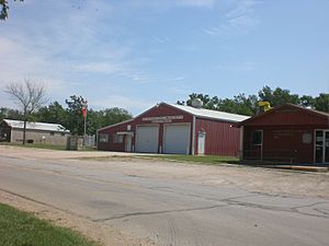
Post office, fire station, ACA Allertor (2012)
|
|

|
|
| Country | United States |
| State | Kansas |
| County | Butler |
| Platted | 1883 |
| Elevation | 1,499 ft (457 m) |
| Population
(2020)
|
|
| • Total | 149 |
| Time zone | UTC-6 (CST) |
| • Summer (DST) | UTC-5 (CDT) |
| ZIP code |
67132
|
| Area code | 620 |
| FIPS code | 20-61100 |
| GNIS ID | 2629173 |
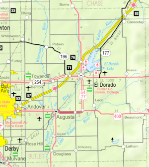
Rosalia is a census-designated place (CDP) in Butler County, Kansas, United States. As of the 2020 census, the population was 149. It is located approximately 12 miles (19 km) east of El Dorado.
History
Rosalia was platted in 1883. The town was named by its first postmaster for his wife.
In 2014 and 2018, the Symphony In The Flint Hills, an outdoor symphony music event, was held a few miles northeast of Rosalia. In 2014, the attendance was over 7000 people.
Geography
Rosalia is located at 37°48′55″N 96°37′11″W / 37.81528°N 96.61972°W (37.8152985, -96.6197416), in the scenic Flint Hills, roughly 12 miles (19 km) east of El Dorado.
Climate
The climate in this area is characterized by hot, humid summers and generally mild to cool winters. According to the Köppen Climate Classification system, Rosalia has a humid subtropical climate, abbreviated "Cfa" on climate maps.
Demographics
| Historical population | |||
|---|---|---|---|
| Census | Pop. | %± | |
| 2010 | 171 | — | |
| 2020 | 149 | −12.9% | |
| U.S. Decennial Census | |||
Education
The community is served by Flinthills USD 492 public school district. The Flinthills High School mascot is the Mustangs.
See also
 In Spanish: Rosalia (Kansas) para niños


