Rockvale, Colorado facts for kids
Quick facts for kids
Rockvale, Colorado
|
|||
|---|---|---|---|

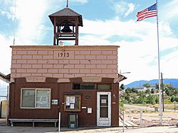
Rockvale's town hall on Railroad St.
|
|||
|
|||

Location of Rockvale in Fremont County, Colorado.
|
|||
| Country | |||
| State | |||
| County | Fremont County | ||
| Incorporated (town) | September 30, 1886 | ||
| Government | |||
| • Type | Statutory Town | ||
| Area | |||
| • Total | 2.04 sq mi (5.28 km2) | ||
| • Land | 2.04 sq mi (5.28 km2) | ||
| • Water | 0.00 sq mi (0.00 km2) | ||
| Elevation | 5,463 ft (1,665 m) | ||
| Population
(2020)
|
|||
| • Total | 511 | ||
| • Density | 250.5/sq mi (96.78/km2) | ||
| Time zone | UTC-7 (Mountain (MST)) | ||
| • Summer (DST) | UTC-6 (MDT) | ||
| ZIP code |
81244 (PO Box)
|
||
| Area code(s) | 719 | ||
| FIPS code | 08-64970 | ||
| GNIS feature ID | 0203568 | ||
| Highways | none | ||
Rockvale is a statutory town in Fremont County, Colorado, United States. The population was 511 at the 2020 census.
Contents
History
Geography
Rockvale is located in southeastern Fremont County at 38°22′8″N 105°9′53″W / 38.36889°N 105.16472°W (38.368845, -105.164813). It is bordered to the north by the town of Williamsburg, and the town of Coal Creek is to the east.
According to the United States Census Bureau, the town of Rockvale has a total area of 1.9 square miles (5.0 km2), all of it land.
Demographics
| Historical population | |||
|---|---|---|---|
| Census | Pop. | %± | |
| 1900 | 870 | — | |
| 1910 | 1,413 | 62.4% | |
| 1920 | 1,249 | −11.6% | |
| 1930 | 710 | −43.2% | |
| 1940 | 575 | −19.0% | |
| 1950 | 380 | −33.9% | |
| 1960 | 413 | 8.7% | |
| 1970 | 359 | −13.1% | |
| 1980 | 338 | −5.8% | |
| 1990 | 321 | −5.0% | |
| 2000 | 426 | 32.7% | |
| 2010 | 487 | 14.3% | |
| 2020 | 511 | 4.9% | |
See also
 In Spanish: Rockvale (Colorado) para niños

All content from Kiddle encyclopedia articles (including the article images and facts) can be freely used under Attribution-ShareAlike license, unless stated otherwise. Cite this article:
Rockvale, Colorado Facts for Kids. Kiddle Encyclopedia.


