River Sem facts for kids
Quick facts for kids River Sem |
|
|---|---|
|
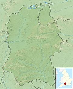
Location of the mouth within Wiltshire
|
|
| Country | United Kingdom |
| Region | Wiltshire |
| Physical characteristics | |
| Main source | East Knoyle, Wiltshire, England 51°04′25″N 2°10′04″W / 51.0737°N 2.1678°W |
| River mouth | Wardour, Wiltshire, England 98 m (322 ft) 51°02′45″N 2°06′37″W / 51.045790°N 2.110142°W |
| Length | 7.03 km (4.37 mi) |
| Basin features | |
| Basin size | 25.6 km2 (9.9 sq mi) |
The River Sem is a natural waterway that flows through the ceremonial county of Wiltshire in England. It flows approximately 4+1⁄4 miles (7 km) from its source near East Knoyle to join the River Nadder near Wardour.
Course
The source is Summerleaze Pond near East Knoyle, just east of the A350. The river flows southeast to Pondhead Copse, below which it flows through two large ponds: Brach Pond and Eeelstage Pond. It then turns east and flows under Savage Bridge and Share Lane before reaching the Nadder, northwest of Wardour.
Tributaries
The river is fed by several small waterways. On its south bank, a stream with a source near Whitebridge Farm southeast of Sedgehill, again close to the A350, flows east to join the Sem near Billhay Farm, above Pondhead Copse.
Also on the south bank, it is fed by a stream that has its source in Bennet's Copse near Hart Hill Stud Farm; this stream flows northeast through Sem Hill and Billhay Pond before joining the Sem at Pondhead Copse.
Geology
The underlying geology is that of Kimmeridge Clay overlaying Limestone. Faults between the two layers give rise to the springs that provide the source of the water for the river catchment.
 | Precious Adams |
 | Lauren Anderson |
 | Janet Collins |


