Rapidan Dam facts for kids
Quick facts for kids Rapidan Dam |
|
|---|---|

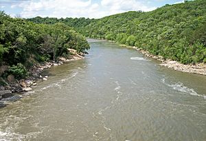
Blue Earth River below Rapidan Dam
|
|
|
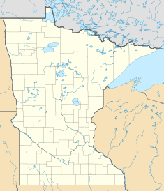
Location of Rapidan Dam in USA Minnesota
|
|
| Country | United States |
| Location | Blue Earth County, Minnesota |
| Coordinates | 44°05′34″N 94°06′31″W / 44.092727°N 94.108662°W |
| Purpose | Power |
| Status | Imminent Failure Condition |
| Construction began | 1908 |
| Opening date | 1910 |
| Owner(s) | Blue Earth County Government |
| Dam and spillways | |
| Type of dam | Concrete Gravity |
| Impounds | Blue Earth River |
| Height | 87 ft (27 m) |
| Length | 475 ft (145 m) |
| Spillways | 5 steel Tainter gates and 2 timber gates |
| Reservoir | |
| Creates | Rapidan Lake |
| Catchment area | 2,430 sq mi (6,300 km2) |
| Surface area | 318 acres (129 ha) |
| Power station | |
| Turbines | 2 |
| Installed capacity | 6 MW (not currently operating) |
The Rapidan Dam is a concrete gravity dam located on the Blue Earth River in Rapidan Township, near Rapidan, Minnesota in the United States. The dam was constructed for hydroelectric power generation from 1908 to 1966. The dam and reservoir are owned by Blue Earth County, and the power plant and dam was operated by Eagle Creek Renewable Energy under an agreement with the county. Power was no longer generated at the dam due to damage from flooding in 2019 and 2020. The dam is located just southwest of Mankato, Minnesota.
Blue Earth County operates the Rapidan Dam Park & Campground on the west embankment of the dam for camping, hiking, river access, and recreational activities.
Contents
History
The dam was built in 1910. It generated power for the Northern States Power Company until it was damaged in 1965 by flooding. In 1970, the dam was acquired by Blue Earth County, which has operated the facility since then.
In 2002 it was discovered that the foundation of the dam needed emergency repairs which were carried out to stop the dam failing. This included filling concrete in a void between several buttresses and part of the base slab at the toe of the spillway. This cost $1,034,000.
Proposed removal
In 2021, the county commissioned two studies to explore the options for addressing the dam’s state of disrepair — either dam repair or dam removal. In April to June 2022, the county collected community feedback regarding these options.
Dam failure
Following flooding on the river due to heavy rain, on June 24, 2024, the Blue Earth River cut through the sides of the dam, and the dam was declared to be in an "imminent failure condition". The river caused flooding and washed away an Xcel Energy substation which provides power to around 600 customers; it also destroyed a shed, and has nearly destroyed a home. A flash flood warning was enacted and residents were urged to evacuate. Dam operators first alerted authorities at around 10:36 a.m. CDT.
Predictions have been made about possible casualties and damage. They indicated that the campground would need to be evacuated, and then the only risk would be to people located on the river itself. The largest damage is predicted to be environmental, as a large amount of sediment has built up in the reservoir, and much of it would eventually wash down river.
See also


