Queen Maud Gulf facts for kids
Quick facts for kids Queen Maud Gulf |
|
|---|---|
| Location | Nunavut, Canada |
| Coordinates | 68°20′N 102°00′W / 68.333°N 102.000°W |
| Type | Gulf |
| Ocean/sea sources | Arctic Ocean |
| Basin countries | Canada |
| Islands | Jenny Lind Island, King William Island, Royal Geographical Society Island |
|
Designations
|
|
| Official name: Queen Maud Gulf | |
| Designated: | 24 May 1982 |
|---|---|
| Reference #: | 246 |
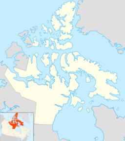
Queen Maud Gulf lies between the northern coast of the mainland and the southeastern corner of Victoria Island in Nunavut, Canada. At its western end lies Cambridge Bay, leading to Dease Strait; to the east lies Simpson Strait; and to the north, Victoria Strait.
History
In 1839 it was crossed by Peter Warren Dease and Thomas Simpson. It was named by the Norwegian explorer Roald Amundsen in 1905 for the Norwegian queen Maud of Wales.
The wreck of HMS Erebus from Franklin's lost expedition of 1845 to find the Northwest Passage was found in 2014. The wreck lies at the bottom of the eastern portion of Queen Maud Gulf, west of O'Reilly Island.
Islands
Islands in the Queen Maud Gulf include:
See also
 In Spanish: Golfo de la Reina Maud para niños

All content from Kiddle encyclopedia articles (including the article images and facts) can be freely used under Attribution-ShareAlike license, unless stated otherwise. Cite this article:
Queen Maud Gulf Facts for Kids. Kiddle Encyclopedia.


