Queanbeyan West facts for kids
Quick facts for kids Queanbeyan WestQueanbeyan, New South Wales |
|||||||||||||||
|---|---|---|---|---|---|---|---|---|---|---|---|---|---|---|---|

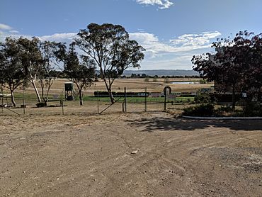
Queanbeyan Race Course
|
|||||||||||||||
| Population | 3,146 (2021 census) | ||||||||||||||
| Postcode(s) | 2620 | ||||||||||||||
| LGA(s) | Queanbeyan-Palerang Regional Council | ||||||||||||||
| County | Murray | ||||||||||||||
| Parish | Queanbeyan | ||||||||||||||
| State electorate(s) | Monaro | ||||||||||||||
| Federal Division(s) | Eden-Monaro | ||||||||||||||
|
|||||||||||||||
Queanbeyan West is a suburb of Queanbeyan, New South Wales, Australia. Queanbeyan West is located west of the central business district (CBD) and also borders the Australian Capital Territory, it is located south of Crestwood and Canberra Avenue and west of Tharwa Road. At the 2021 census, it had a population of 3,146.

All content from Kiddle encyclopedia articles (including the article images and facts) can be freely used under Attribution-ShareAlike license, unless stated otherwise. Cite this article:
Queanbeyan West Facts for Kids. Kiddle Encyclopedia.

