Puelo River facts for kids
Quick facts for kids Puelo River |
|
|---|---|

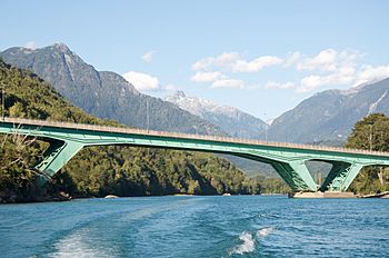
Bridge on the Carretera Austral
|
|
|
Location of mouth
|
|
| Countries | |
| Physical characteristics | |
| Main source | Puelo Lake |
| River mouth | Reloncaví Estuary (Pacific Ocean) 42°07′00″S 71°43′00″W / 42.116667°S 71.716667°W |
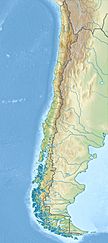
The Puelo River has its origin in Lake Puelo in Argentine, and flows north-west through the Andes into Chile and the Reloncaví Estuary of the Reloncaví Sound at the northern end of the Gulf of Ancud.
Course
Just 800 metres (2,600 ft) downstream from its source in Puelo Lake, the river enters Inferior Lake. After leaving the lake, the river flows in a generally northwesterly direction, receiving the waters of a chain of lakes, the largest being Azul and Las Rocas. It also receives the waters of Ventisquero and Traidor rivers. A part of the northernmost border of Pumalín Park approximately parallels the course of the Ventisquero River. Traidor River rises in Hornopirén National Park.
A large northern tributary of the Puelo, the Manso, has its sources in Mascardi Lake and other lakes and streams south-east of the Cerro Tronador, also in Argentina, and flows south-west through the Andes to unite with the Puelo a few kilometers west of the 72nd meridian. Puelo river's lower course is impeded in such a manner as to form three small lakes, called Superior, Inferior and the Tagua Tagua Lake.
See also
 In Spanish: Río Puelo para niños


