Province of Pesaro and Urbino facts for kids
Quick facts for kids
Province of Pesaro and Urbino
Pesaro e Urbino
|
|
|---|---|
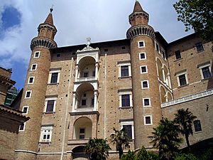
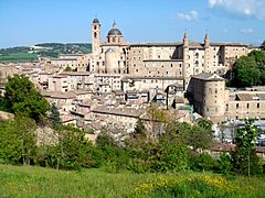
The Ducal Palace of Urbino
|
|
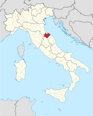
Map with the province of Pesaro and Urbino, in red, in Italy
|
|
| Country | |
| Region | Marche |
| Capital | Pesaro |
| Comuni | 54 |
| Area | |
| • Total | 2,567.78 km2 (991.43 sq mi) |
| Population
(January 2017)
|
|
| • Total | 360,711 |
| • Density | 140.4758/km2 (363.8307/sq mi) |
| Time zone | UTC+1 (CETU) |
| • Summer (DST) | UTC+2 (CEST) |
| Postal code |
61100
|
| Telephone prefix | 0721 Pesaro 0722 Urbino |
| Vehicle registration | PU |
| ISTAT | 041 |
| Website | Official website: http://www.provincia.pu.it/ |
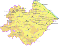
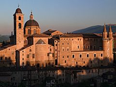
The Province of Pesaro and Urbino (Italian: Provincia di Pesaro e Urbino) is a province in the Marche region of Italy. Its capital is the city of Pesaro.
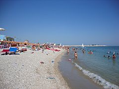
The province is also known as "Riviera of Hills". It is mostly covered by hills and is popular for its beaches..
Contents
Geography
Pesaro and Urbino has an area of 2,567.78 km2 (991 sq mi), the second largest province of the Marche after the Macerata province. The province is surrounded by the state of San Marino and Emilia-Romagna in the north, Umbria and Tuscany in the west, Ancona in the south and the Adriatic Sea on the east.
 |
San Marino | Emilia-Romagna | Adriatic Sea |  |
| Tuscany | Adriatic Sea | |||
| Umbria | Ancona (province) |
The main rivers in the province, from north to south, are (all of them flow to the east into the Adriatic Sea)ː
- Conca - 47 km long; its mouth is between Cattolica and Misano Adriatico.
- Foglia - 90 km long; its mouth is in Pesaro.
- Metauro 121 km long; its mouth is in Fano.
- Cesano - 62 km long; it forms partially the limit with the province of Ancona and its mouth is near Senigallia.
The highest mountain in the province is Monte Catria,(43°27′40″N 12°42′15″E / 43.46111°N 12.70417°E) in the Apennines; it is 1,701 m (5,581 ft) high.
Population
There are 360,711 persons living in the province (1 January 2017), for a population density of 140.5 inhabitants/km².
Evolution of the population

Municipalities
There are 54 municipalities (or comuni) in the province; they are:
- Acqualagna
- Apecchio
- Auditore
- Belforte all'Isauro
- Borgo Pace
- Cagli
- Cantiano
- Carpegna
- Cartoceto
- Colli al Metauro
- Fano
- Fermignano
- Fossombrone
- Fratte Rosa
- Frontino
- Frontone
- Gabicce Mare
- Gradara
- Isola del Piano
- Lunano
- Macerata Feltria
- Mercatello sul Metauro
- Mercatino Conca
- Mombaroccio
- Mondavio
- Mondolfo
- Monte Cerignone
- Monte Grimano Terme
- Monte Porzio
- Montecalvo in Foglia
- Monteciccardo
- Montecopiolo
- Montefelcino
- Montelabbate
- Peglio
- Pergola
- Pesaro
- Petriano
- Piandimeleto
- Pietrarubbia
- Piobbico
- San Costanzo
- San Lorenzo in Campo
- Sant'Angelo in Vado
- Sant'Ippolito
- Sassocorvaro
- Sassofeltrio
- Serra Sant'Abbondio
- Tavoleto
- Tavullia
- Terre Roveresche
- Urbania
- Urbino
- Vallefoglia
The largest comune is Urbino, with 226.50 km2 (87 sq mi) and the smallest is Gabicce Mare, with 4.94 km2 (2 sq mi). The comune with fewest people living in it is Frontino with 293 inhabitants.
Main comuni
The following table shows the 10 comuni with more inhabitants with their population, and their area and altitude.
| No. | Comune | Population (2017) |
Area (km²) |
Density | Altitude (m) |
|---|---|---|---|---|---|
| 1 | Pesaro | 94,813 | 126.77 | 747.9 | 11 |
| 2 | Fano | 60,852 | 121.84 | 499.4 | 12 |
| 3 | Vallefoglia | 15,016 | 39.57 | 379.5 | 280 |
| 4 | Urbino | 14,844 | 226.50 | 65.5 | 485 |
| 5 | Mondolfo | 14,235 | 22.82 | 623.8 | 144 |
| 6 | Colli al Metauro | 12,400 | 46.17 | 268.6 | 66 |
| 7 | Fossombrone | 9,528 | 106.88 | 89.1 | 118 |
| 8 | Cagli | 8,652 | 226.46 | 38.2 | 276 |
| 9 | Fermignano | 8,563 | 43.70 | 195.9 | 200 |
| 10 | Tavullia | 7,987 | 42.07 | 189.9 | 170 |
Twinned and partner towns
The province of Pesaro and Urbino is twinned with:
Gallery
Related pages
Images for kids
See also
 In Spanish: Provincia de Pesaro y Urbino para niños


