Pripyat facts for kids
Quick facts for kids
Pripyat
Прип'ять
|
||
|---|---|---|
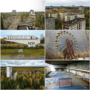
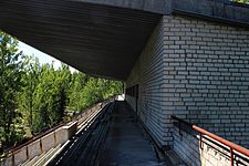
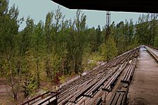
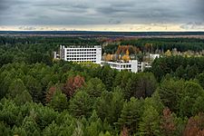
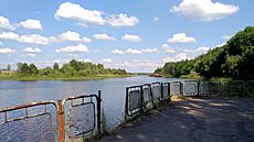
Clockwise from top-left:
|
||
|
||
| Country | ||
| Oblast | Kyiv Oblast | |
| Raion |
|
|
| Founded | 4 February 1970 | |
| City rights | 1979 | |
| Area | ||
| • Total | 8 km2 (3 sq mi) | |
| Elevation | 111 m (364 ft) | |
| Population
(2023)
|
||
| • Total | 0 | |
| (c. 49,000 in 1986) | ||
| Time zone | UTC+02:00 (EET) | |
| • Summer (DST) | UTC+03:00 (EEST) | |
| Postal code |
None (formerly 01196)
|
|
| Area code(s) | +380 4499 | |
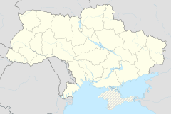
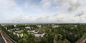
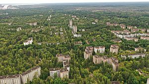
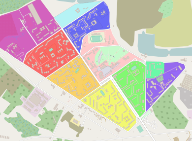
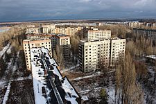
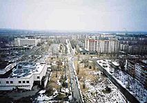
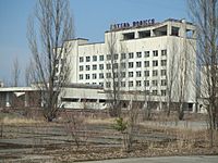
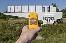
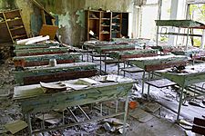
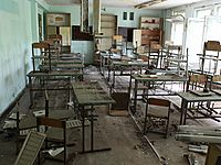
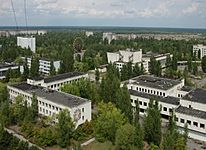
Pripyat (/ˈpriːpjət, ˈprɪp-/ pree-PYƏT-,_-PRIP-yət; Russian: Припять, IPA: [ˈprʲipʲɪtʲ]), also known as Prypiat (Ukrainian: Припʼять, IPA: [ˈprɪpjɐtʲ]), is a mostly abandoned city in northern Ukraine, located near the border with Belarus. Named after the nearby river, Pripyat, it was founded on 4 February 1970 as the ninth atomgrad (a type of closed city in the Soviet Union) to serve the nearby Chernobyl Nuclear Power Plant, which is located in the adjacent abandoned Chernobyl. Pripyat was officially proclaimed a city in 1979 and had grown to a population of 49,360 by the time it was evacuated on the afternoon of 27 April 1986, one day after the Chernobyl disaster.
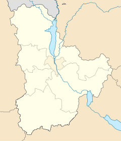
Although it was located within the administrative district of Ivankiv Raion (now Vyshhorod Raion since the 2020 raion reform), the abandoned municipality now has the status of city of regional significance within the larger Kyiv Oblast, and is administered directly from the capital of Kyiv. Pripyat is supervised by the State Emergency Service of Ukraine which manages activities for the entire Chernobyl exclusion zone. Following the 1986 Chernobyl nuclear disaster, the entire population of Pripyat was moved to the purpose-built city of Slavutych.
Contents
History
Early years
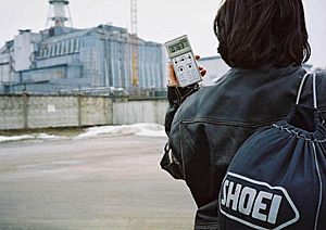
Access to Pripyat, unlike cities of military importance, was not restricted before the disaster as the Soviet Union deemed nuclear power stations safer than other types of power plants. Nuclear power stations were presented as achievements of Soviet engineering, harnessing nuclear power for peaceful projects. The slogan "peaceful atom" (Russian: мирный атом, romanized: mirnyy atom) was popular during those times. The original plan had been to build the plant only 25 km (16 mi) from Kyiv, but the Ukrainian Academy of Sciences, among other bodies, expressed concern that would be too close to the city. As a result, the power station and Pripyat were built at their current locations, about 100 km (62 mi) from Kyiv.
Post-Chernobyl disaster
In 1986, the city of Slavutych was constructed to replace Pripyat. After Chernobyl, this was the second-largest city for accommodating power plant workers and scientists in the Commonwealth of Independent States.
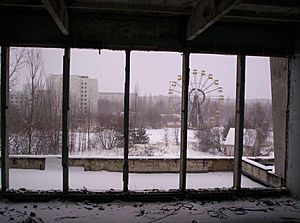
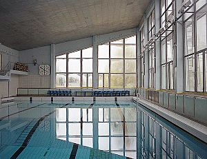
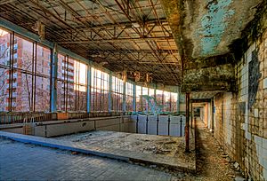
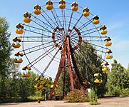
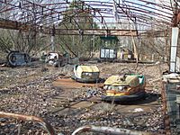
One notable landmark often featured in photographs in the city and visible from aerial-imaging websites is the long-abandoned Ferris wheel located in the Pripyat amusement park, which had been scheduled to have its official opening five days after the disaster, in time for May Day celebrations. The Azure Swimming Pool and Avanhard Stadium are two other popular tourist sites.
On 4 February 2020, former residents of Pripyat gathered in the abandoned city to celebrate the 50th anniversary of Pripyat's establishment. This was the first time former residents returned to the city since its abandonment in 1986. The 2020 Chernobyl Exclusion Zone wildfires reached the outskirts of the town, but they did not reach the plant.
During the 2022 Russian invasion of Ukraine, the city was occupied by Russian forces during the Battle of Chernobyl after several hours of heavy fighting. On 31 March Russian troops withdrew from the plant and other parts of Kyiv Oblast. On 3 April Ukrainian troops took control of Pripyat again.
Infrastructure and statistics
The following statistics are from 1 January 1986.
- The population was 49,400. The average age was about 26 years old. Total living space was 658,700 m2 (7,090,000 sq ft): 13,414 apartments in 160 apartment blocks, 18 halls of residence accommodating up to 7,621 single males or females, and eight halls of residence for married or de facto couples.
- Education: 15 kindergartens and elementary schools for 4,980 children, and five secondary schools for 6,786 students.
- Healthcare: one hospital could accommodate up to 410 patients, and three clinics.
- Trade: 25 stores and malls; 27 cafes, cafeterias, and restaurants collectively could serve up to 5,535 customers simultaneously. 10 warehouses could hold 4,430 tons of goods.
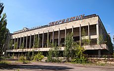
- Culture: the Palace of Culture Energetik; a cinema; and a school of arts, with eight different societies.
- Sports: 10 gyms, 10 shooting galleries, three indoor swimming-pools, two stadiums.
- Recreation: one park, 35 playgrounds, 18,136 trees, 33,000 rose plants, 249,247 shrubs.
- Industry: four factories with annual turnover of 477,000,000 rubles. One nuclear power plant with four reactors (plus two more planned).
- Transportation: Yanov railway station, 167 urban buses, plus the nuclear power plant car park with 400 spaces.
- Telecommunication: 2,926 local phones managed by the Pripyat Phone Company, plus 1,950 phones owned by Chernobyl power station's administration, Jupiter plant, and Department of Architecture and Urban Development.
Safety
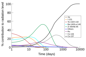
A concern is whether it is safe to visit Pripyat and its surroundings. The Zone of Alienation is considered relatively safe to visit, and several Ukrainian companies offer guided tours around the area. In most places within the city, the level of radiation does not exceed an equivalent dose of 1 μSv (one microsievert) per hour.
Climate
The climate of Pripyat is designated as Dfb (Warm-summer humid continental climate) on the Köppen Climate Classification System.
| Climate data for Pripyat | |||||||||||||
|---|---|---|---|---|---|---|---|---|---|---|---|---|---|
| Month | Jan | Feb | Mar | Apr | May | Jun | Jul | Aug | Sep | Oct | Nov | Dec | Year |
| Mean daily maximum °C (°F) | −3 (27) |
−1.4 (29.5) |
3.7 (38.7) |
13.2 (55.8) |
20.3 (68.5) |
23.5 (74.3) |
24.6 (76.3) |
23.9 (75.0) |
18.8 (65.8) |
11.8 (53.2) |
4.3 (39.7) |
−0.1 (31.8) |
11.6 (53.0) |
| Daily mean °C (°F) | −6.1 (21.0) |
−4.7 (23.5) |
0.1 (32.2) |
8.4 (47.1) |
14.8 (58.6) |
18.0 (64.4) |
19.1 (66.4) |
18.4 (65.1) |
13.7 (56.7) |
7.8 (46.0) |
1.8 (35.2) |
−2.6 (27.3) |
7.4 (45.3) |
| Mean daily minimum °C (°F) | −9.1 (15.6) |
−9 (16) |
−3.5 (25.7) |
3.7 (38.7) |
9.3 (48.7) |
12.6 (54.7) |
13.7 (56.7) |
12.9 (55.2) |
8.6 (47.5) |
3.8 (38.8) |
−0.7 (30.7) |
−5.1 (22.8) |
3.1 (37.6) |
Transport
The city was served by Yaniv station on the Chernihiv–Ovruch railway. It was an important passenger hub of the line and was located between the southern suburb of Pripyat and Yaniv. An electric train terminus of Semikhody, built in 1988 and located in front of the nuclear plant, is currently the only operating station near Pripyat connecting it to Slavutych.
Notable people
- Markiyan Kamysh (born 1988) writer, illegal Chernobyl explorer ("stalker")
- Vitali Klitschko (born 1971) politician, mayor of Kyiv and former professional boxer
- Wladimir Klitschko (born 1976) former professional boxer
- Alexander Sirota (born 1976) photographer, journalist and filmmaker
- Lyubov Sirota (born 1956) poet, writer, playwright, journalist and translator
Gallery
See also
 In Spanish: Prípiat para niños


