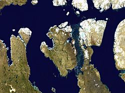
Prince of Wales Island (Nunavut) facts for kids
Prince of Wales Island one of the bigger members of the Canadian Arctic Archipelago. It is an Arctic island in Nunavut, Canada, between Victoria Island and Somerset Island and south of the Queen Elizabeth Islands.
It is a low tundra-covered island with an irregular coastline deeply indented by Ommanney Bay in the west and Browne Bay in the east. Its area has been thought to be around 33 339 km². Prince of Wales Island is the world's 40th biggest island and the 10th biggest in Canada. Its highest known point, found at 73°49'N; 97°50'W – and 320 m high – is an unnamed spot in the island's far northeastern end [1] overlooking the Baring Channel, which separates the island from nearby Russell Island.
Images for kids
-
Polar bear on an ice floe in Franklin Strait east of Prince of Wales Island in September 2019; the bloody trail shows its prey was dragged over the floe.
See also
 In Spanish: Isla del Príncipe de Gales (Nunavut) para niños


