President Range facts for kids
Quick facts for kids President Range |
|
|---|---|

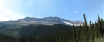
The President Range in Yoho National Park
|
|
| Highest point | |
| Peak | The President |
| Elevation | 3,138 m (10,295 ft) |
| Dimensions | |
| Area | 120 km2 (46 sq mi) |
| Geography | |
| Country | Canada |
| State/Province | British Columbia |
| Parent range | Canadian Rockies |
The President Range is a mountain range of the Canadian Rockies, located in the northwestern section of Yoho National Park. The range is named for the highest peak in the range, The President.
This range includes the following mountains and peaks:
| Mountain/Peak | metres | feet |
|---|---|---|
| The President | 3,138 | 10,296 |
| The Vice President | 3,066 | 10,060 |
| Mount Carnarvon | 3,046 | 9,993 |
| Emerald Peak | 2,701 | 8,862 |
| Michael Peak | 2,696 | 8,844 |
| Mount Field | 2,623 | 8,671 |

All content from Kiddle encyclopedia articles (including the article images and facts) can be freely used under Attribution-ShareAlike license, unless stated otherwise. Cite this article:
President Range Facts for Kids. Kiddle Encyclopedia.