Portage Lake (Alaska) facts for kids
Quick facts for kids Portage Lake |
|
|---|---|

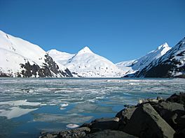
Portage Lake, as seen from the Western edge near the Begich Boggs Visitor Center with Bard Peak in the distance
|
|
| Location | Chugach National Forest, Alaska, United States |
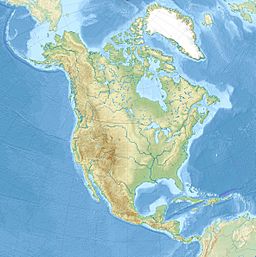
| Coordinates | 60°46′27″N 148°49′0″W / 60.77417°N 148.81667°W |
| Primary inflows | Placer Creek, Mallott Creek |
| Primary outflows | Portage Creek |
| Basin countries | United States |
| Max. length | 3.0 mi (4.8 km) |
| Max. width | .89 mi (1.43 km) |
| Average depth | 600 ft (180 m) |
| Islands | none |
Portage Lake is a glacial lake in the Chugach National Forest of Alaska. It sits in a long, heavily glaciated valley, and abuts the calving face of Portage Glacier at its southern end. The lake has only become visible since approximately 1914, with the rapid retreat of Portage Glacier.
Access and recreation
The western shore of Portage Lake is easily accessed via a large parking lot at the lakeside Begich Boggs Visitor Center, just off the Portage Glacier Highway. Portage Glacier Cruises operates a short glacier cruise, which takes visitors near the face of the glacier. Recreational boating in the lake was illegal in the past, due to rolling icebergs and the calving face of Portage Glacier at the far end of the lake, but is now legal, though proper precautions must be taken for the challenging conditions.
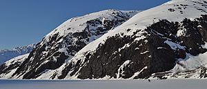
During winter and spring, the lake is a popular destination for cross-country skiing, kite skiing, mountain biking, skating, snowshoe running, and hiking. The "crust skiing" season of mid spring is especially prized by skiers. Skiers must take appropriate precautions near Portage Glacier, as the constant movement of the glacier's calving face breaks up even thick lake ice and can create patches of open water or unstable ice near the glacier's face, even in midwinter.


