Ponor Saddle facts for kids
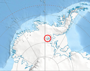
Ponor Saddle (Bulgarian: седловина Понор, ‘Sedlovina Ponor’ \se-dlo-vi-'na po-'nor\) is the 1.6 km long ice-covered flat saddle of elevation 2000 m linking Mount Allen and Mount Liptak in southern Sentinel Range, Ellsworth Mountains of Antarctica. It is part of the glacial divide between Bolgrad Glacier and Kornicker Glacier.
The feature is named after the settlement of Ponor in western Bulgaria.
Location
The midpoint of Ponor Saddle is located at 78°43′00″S 84°58′00″W / 78.71667°S 84.96667°W, which is 1.44 km north of Mount Liptak, 4 km east-southeast of Krusha Peak, and 2.38 km south-southeast of Mount Allen, according to US mapping in 1988.
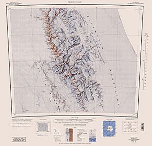
Maps
Black History Month on Kiddle
Famous African-American Inventors:
 | George Robert Carruthers |
 | Patricia Bath |
 | Jan Ernst Matzeliger |
 | Alexander Miles |

All content from Kiddle encyclopedia articles (including the article images and facts) can be freely used under Attribution-ShareAlike license, unless stated otherwise. Cite this article:
Ponor Saddle Facts for Kids. Kiddle Encyclopedia.

