Pollard, Kansas facts for kids
Quick facts for kids
Pollard, Kansas
|
|
|---|---|

|
|
| Country | United States |
| State | Kansas |
| County | Rice |
| Township | Victoria |
| Elevation | 1,736 ft (529 m) |
| Time zone | UTC-6 (CST) |
| • Summer (DST) | UTC-5 (CDT) |
| Area code | 620 |
| FIPS code | 20-56975 |
| GNIS ID | 484741 |
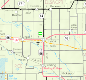
Pollard is an unincorporated community in Victoria Township, Rice County, Kansas, United States. It lies a fraction of a mile (about 1 km) west of K-14, 6 miles (9.7 km) southwest of Geneseo and 7 miles (11 km) north of Lyons.
History
For millennia, the land now known as Kansas was inhabited by Native Americans. In 1803, most of modern Kansas was secured by the United States as part of the Louisiana Purchase. In 1854, the Kansas Territory was organized, then in 1861 Kansas became the 34th U.S. state. In 1867, Rice County was founded.
Pollard had a post office from 1888 until 1923.
Education
The community is served by Lyons USD 405 public school district.

All content from Kiddle encyclopedia articles (including the article images and facts) can be freely used under Attribution-ShareAlike license, unless stated otherwise. Cite this article:
Pollard, Kansas Facts for Kids. Kiddle Encyclopedia.


