Pinery, South Australia facts for kids
Quick facts for kids PinerySouth Australia |
|||||||||||||||
|---|---|---|---|---|---|---|---|---|---|---|---|---|---|---|---|

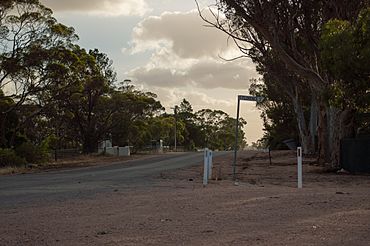
Corner of Thornton Road and Florence Street
|
|||||||||||||||
| Postcode(s) | 5460 | ||||||||||||||
| Location | 70 km (43 mi) N of Adelaide | ||||||||||||||
| LGA(s) | Wakefield Regional Council | ||||||||||||||
| State electorate(s) | Narungga | ||||||||||||||
| Federal Division(s) | Grey | ||||||||||||||
|
|||||||||||||||
Pinery is a locality in South Australia's lower Mid North. At the 2006 census, Pinery had a population of 279 but the locality was included with the town of Owen in the 2011 census (population 634) and residents were not counted separately. Both of those were a much larger area than the area which had 102 residents in 2016.

All content from Kiddle encyclopedia articles (including the article images and facts) can be freely used under Attribution-ShareAlike license, unless stated otherwise. Cite this article:
Pinery, South Australia Facts for Kids. Kiddle Encyclopedia.

