Petrolia, Kansas facts for kids
Quick facts for kids
Petrolia, Kansas
|
|
|---|---|

|
|
| Country | United States |
| State | Kansas |
| County | Allen |
| Elevation | 955 ft (291 m) |
| Time zone | UTC-6 (CST) |
| • Summer (DST) | UTC-5 (CDT) |
| ZIP code |
66720
|
| Area code | 620 |
| FIPS code | 20-55625 |
| GNIS ID | 474962 |
Petrolia is an unincorporated community in Allen County, Kansas, United States. It is situated along the Neosho River.
History
In 1910, Petrolia had a money order postoffice, an express office, and was a trading point for the neighborhood. The population that year was 200.
Petrolia had a post office from July 1905 until September 1953.
Geography
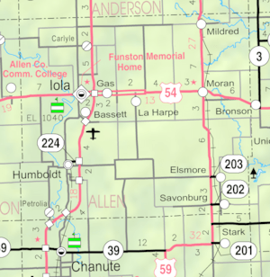
Petrolia is located in Sections 31–32, Township 26 south, Range 18 east. Less than a mile from the southern border of Allen County, it is situated west of the Neosho River and to the south of Scatter Creek. Contained entirely within Logan Township, it is about 5 miles south-southwest of Humboldt and 13 miles from Iola (the county seat). U.S. Route 169 crosses the Neosho River a mile to the south of Petrolia.
Education
The community is served by Chanute USD 413 public school district.


