Patharghata Upazila facts for kids
Quick facts for kids
Patharghata Upazila
পাথরঘাটা উপজেলা
|
|
|---|---|
|
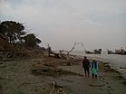
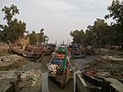
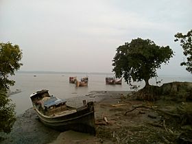
Skyline of Patharghata, Bangladesh
|
|
| Country | |
| Division | Barisal Division |
| District | Barguna District |
| Area | |
| • Total | 387.36 km2 (149.56 sq mi) |
| Population
(1991)
|
|
| • Total | 134,635 |
| • Density | 347.571/km2 (900.204/sq mi) |
| Time zone | UTC+6 (BST) |
| Website | Official Map of the Patharghata Upazila: http://lib.pmo.gov.bd/maps/images/barguna/Patharghata.gif |
Patharghata (Bengali: পাথরঘাটা উপজেলা) is an Upazila of Barguna District in Bangladesh. It is a part of the Barisal Division. It has a total area of 387.36 km2.
Administration
Patharghata Upazila is divided into Patharghata Municipality and seven union parishads. The list of union parishads:
| No. | Name of the Union |
|---|---|
| 1 | Charduani |
| 2 | Kakchira |
| 3 | Kalmegha |
| 4 | Kanthaltali |
| 5 | Nachna Para |
| 6 | Patharghata |
| 7 | Raihanpur |
The union parishads are subdivided into 42 mauzas and 66 villages. Patharghata Municipality is subdivided into 9 wards and 9 mahallas.
See also
 In Spanish: Patharghata para niños

All content from Kiddle encyclopedia articles (including the article images and facts) can be freely used under Attribution-ShareAlike license, unless stated otherwise. Cite this article:
Patharghata Upazila Facts for Kids. Kiddle Encyclopedia.


