Parkend, Lewis facts for kids
Quick facts for kids Parkend
|
|
|---|---|
 A view across a field to the Parkend Industrial Estate |
|
| Language | Scottish Gaelic English |
| OS grid reference | NB449318 |
| Civil parish | |
| Council area | |
| Lieutenancy area | |
| Country | Scotland |
| Sovereign state | United Kingdom |
| Post town | STORNOWAY |
| Postcode district | HS2 |
| Dialling code | 01851 |
| Police | Northern |
| Fire | Highlands and Islands |
| Ambulance | Scottish |
| EU Parliament | Scotland |
| UK Parliament |
|
| Scottish Parliament |
|
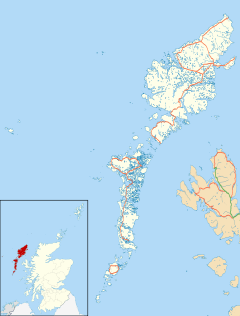
Parkend (Scottish Gaelic: Ceann nam Buailtean) is a hamlet in the Sandwick region of the Isle of Lewis, although like Melbost, it is not a part of the Eye Peninsula. Many people erroneously believe it to be a suburb of Stornoway, on the island of Lewis and Harris in the Outer Hebrides of Scotland. Parkend is within the parish of Stornoway. Parkend is situated on the A866, and the adjoining Holm Road allows access to the nearby Holm Village. The Parkend Industrial Estate is adjacent to the small housing estate.

All content from Kiddle encyclopedia articles (including the article images and facts) can be freely used under Attribution-ShareAlike license, unless stated otherwise. Cite this article:
Parkend, Lewis Facts for Kids. Kiddle Encyclopedia.

