
Pampas, Peru facts for kids
Quick facts for kids
Pampas
|
|||
|---|---|---|---|

Plaza de Armas, Pampas
|
|||
|
|||
| Nickname(s):
Ciudad de los Cuchimichis (The Cuchimichis City)
|
|||

Pampas, Peru
Location in Peru
|
|||
| Country | Peru | ||
| Region | Huancavelica | ||
| Province | Tayacaja | ||
| Established | 21 June 1825 | ||
| Area | |||
| • Total | 52.264 km2 (20.179 sq mi) | ||
| Elevation | 3,276 m (10,748 ft) | ||
| Population | |||
| • Total | 11,566 | ||
| • Density | 221.3/km2 (573/sq mi) | ||
| Time zone | UTC-5 (PET) | ||
| • Summer (DST) | UTC-5 (PET) | ||
| Area code(s) | 067 | ||
| Website | www.munitayacaja.gob.pe | ||


Pampas is a city in Peru. It is the capital of the Tayacaja Province and it was established on June 21, 1825. According to the 2007 census had a population of 9,973 (11,566 in the metropolitan area). It has an approximate altitude of 3,276 metres.
Contents
Transportation
The city is connected to the nearby cities like Huancayo and Ayacucho by partially paved roads.
Education
The city house a branch of the Universidad Nacional de Huancavelica and it is home of a local technical institute; the Instituto Tecnologico Pampas - Tayacaja.
Images for kids
-
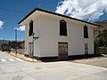
A house in Pampas.
-
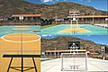
Futsal court in Pampas.
-
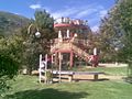
Slide in the "Parque Ecolgico de Pampas".
-
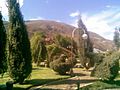
Gardens in the "Parque Ecolgico de Pampas".
-
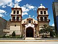
Cathedral of San Pedro de Pampas.
-
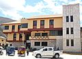
Municipality of Pampas.
-
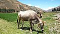
A cow in Pampas.
-
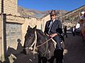
Pampino.


See also
 In Spanish: Pampas para niños

All content from Kiddle encyclopedia articles (including the article images and facts) can be freely used under Attribution-ShareAlike license, unless stated otherwise. Cite this article:
Pampas, Peru Facts for Kids. Kiddle Encyclopedia.