Ouderkerk facts for kids
For other uses, see Ouderkerk (disambiguation).
Quick facts for kids
Ouderkerk
|
|||
|---|---|---|---|
|
Former municipality
|
|||

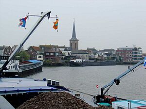
View over Ouderkerk aan den IJssel
|
|||
|
|||

Location in South Holland
|
|||
| Country | Netherlands | ||
| Province | South Holland | ||
| Municipality | Krimpenerwaard | ||
| Established | 1 January 1985 | ||
| Area | |||
| • Total | 28.57 km2 (11.03 sq mi) | ||
| • Land | 27.07 km2 (10.45 sq mi) | ||
| • Water | 1.50 km2 (0.58 sq mi) | ||
| Elevation | 0 m (0 ft) | ||
| Population
(May 2014)
|
|||
| • Total | 8,200 | ||
| • Density | 303/km2 (780/sq mi) | ||
| Demonym(s) | Ouderkerker | ||
| Time zone | UTC+1 (CET) | ||
| • Summer (DST) | UTC+2 (CEST) | ||
| Postcode |
2830–2831, 2935
|
||
| Area code | 0180, 0182 | ||
Ouderkerk (Dutch pronunciation: [ˈʌudərˌkɛr(ə)k]) is a former municipality in the western Netherlands, in the province of South Holland. Since 2015 it has been a part of the municipality of Krimpenerwaard.
The former municipality covered an area of 28.57 km2 (11.03 sq mi) of which 1.50 km2 (0.58 sq mi) was water. It was formed on 1 January 1985, after a municipal reorganization.
The former municipality of Ouderkerk consisted of the population centres Gouderak, Lageweg, Ouderkerk aan den IJssel, and IJssellaan, all situated along the Hollandse IJssel river.
Topography
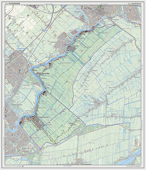
Dutch Topographic map of the former municipality of Ouderkerk, 2013.
Black History Month on Kiddle
Famous African-American Civil Rights Activists
 | Roy Wilkins |
 | John Lewis |
 | Linda Carol Brown |

All content from Kiddle encyclopedia articles (including the article images and facts) can be freely used under Attribution-ShareAlike license, unless stated otherwise. Cite this article:
Ouderkerk Facts for Kids. Kiddle Encyclopedia.


