Ontario Highway 4 facts for kids
Quick facts for kids
Highway 4 |
||||||||||
|---|---|---|---|---|---|---|---|---|---|---|

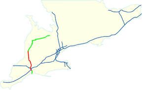
Location of Highway 4 in Southern Ontario
Current route Former route |
||||||||||
| Route information | ||||||||||
| Length | 100.8 km (62.6 mi) | |||||||||
| Existed | February 26, 1920–present | |||||||||
| Major junctions | ||||||||||
| South end | ||||||||||
| North end | ||||||||||
| Location | ||||||||||
| Major cities: | St. Thomas, London | |||||||||
| Towns: | Exeter, Clinton | |||||||||
| Highway system | ||||||||||
|
||||||||||
King's Highway 4, also known as Highway 4, is a provincial highway in Ontario, Canada. It starts at Highway 3 in Southwold. It then continues northward until ending at Highway 8 in Clinton. It is 100.8 kilometers (62.6 miles) long. The highway passes through Elgin County, Middlesex County, and Huron County. It also passes through the major cities of St. Thomas and London.
Images for kids
-
Former alignment of Highway 4 looking north towards Lambeth from the Highway 402 interchange in London

All content from Kiddle encyclopedia articles (including the article images and facts) can be freely used under Attribution-ShareAlike license, unless stated otherwise. Cite this article:
Ontario Highway 4 Facts for Kids. Kiddle Encyclopedia.


