Ontario Highway 28 facts for kids
Quick facts for kids
Highway 28 |
||||||||||
|---|---|---|---|---|---|---|---|---|---|---|
| Lua error in Module:Infobox_road/map at line 15: attempt to index field 'wikibase' (a nil value). | ||||||||||
| Route information | ||||||||||
| Maintained by the Ministry of Transportation of Ontario | ||||||||||
| Length | 162.6 km (101.0 mi) | |||||||||
| Major junctions | ||||||||||
| South end | ||||||||||
| East end | ||||||||||
| Highway system | ||||||||||
|
||||||||||
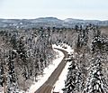
Ontario Highway 28 is a provincial highway in Ontario, Canada. It runs from southwest to northeast and is 162.6 kilometers (101 miles) long. It starts at an intersection with Highway 7 about 7 kilometers (4.3 miles) east of Peterborough. It ends at the town of Denbigh at a junction with Highway 41. The highway originally continued south of Peterborough and into Northumberland County but in 1997 and 1998, the southern 63 kilometers (39 miles) of the highway was transferred to local control.
Images for kids

All content from Kiddle encyclopedia articles (including the article images and facts) can be freely used under Attribution-ShareAlike license, unless stated otherwise. Cite this article:
Ontario Highway 28 Facts for Kids. Kiddle Encyclopedia.


