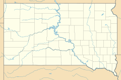
Okreek, South Dakota facts for kids
Quick facts for kids
Okreek
|
|
|---|---|
| Country | United States |
| State | South Dakota |
| County | Todd |
| Area | |
| • Total | 45.05 sq mi (116.67 km2) |
| • Land | 45.00 sq mi (116.55 km2) |
| • Water | 0.04 sq mi (0.12 km2) |
| Elevation | 2,346 ft (715 m) |
| Population
(2020)
|
|
| • Total | 190 |
| • Density | 4.22/sq mi (1.63/km2) |
| Time zone | UTC-6 (Central (CST)) |
| • Summer (DST) | UTC-5 (CDT) |
| ZIP codes |
57563
|
| FIPS code | 46-46660 |
| GNIS feature ID | 2584563 |
Okreek is an unincorporated community in Todd County, South Dakota, United States. As of the 2020 Census, the population was 190. The town is wholly within the jurisdiction of the Rosebud Indian Reservation, and the populace is almost entirely Sioux-American. Okreek consists primarily of two long blocks of inhabited tract housing, and has about 30 private telephone subscribers within town limits. There is also an elementary school and a Post Office which has been assigned the ZIP Code of 57563.
The name Okreek is a corruption of Oak Creek, a stream near the town site.
Demographics
| Historical population | |||
|---|---|---|---|
| Census | Pop. | %± | |
| 2020 | 190 | — | |
| U.S. Decennial Census | |||
See also
 In Spanish: Okreek para niños

All content from Kiddle encyclopedia articles (including the article images and facts) can be freely used under Attribution-ShareAlike license, unless stated otherwise. Cite this article:
Okreek, South Dakota Facts for Kids. Kiddle Encyclopedia.


