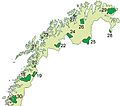
Northern Norway is a geographical region of Norway. It is the three northernmost counties Nordland, Troms and Finnmark.
Northern Norway has a total of about 35% of the Norwegian mainland. Some of the largest towns in Northern Norway (from south to north) are Mo i Rana, Bodø, Narvik, Harstad, Tromsø and Alta. Northern Norway is often described as the land of the midnight sun and the land of the northern lights.
Images for kids
-
Some of the major islands in Northern Norway
-
The islands along the coast creates sheltered sounds on the inside, as here at Senja.
-
Målselva is one of the larger rivers; Målselv municipality.
-
National parks in Northern Norway. Lomsdal-Visten National Park was established May 2009 (no 30). Børgefjell National Park is shared with Nord-Trøndelag and does not show up on map.
-
The many fjords vary in size and topography. The bedrock and soil in the surrounding land also varies. Eidsfjorden in Sortland, Vesterålen.
-
-
The medieval Alstahaug Church.
-
Gullgubber from the Iron Age, the oldest Toreutics in Northern Europe; this one found in Kongsvik, Tjeldsund, Nordland.
-
Cod fisheries have for more than 1,000 years been of great economic importance to the region. From Svolvær harbour by Gunnar Berg.
-
Bodø was an important air base during the Cold War. In more recent years, Norwegian F-16s have deployed to Balkans and Afghanistan.
-
Samediggi – the Sami Parliament in Karasjok.
-
Treriksrøysa where Norway, Sweden and Finland meet each other.
-
Russian immigration and travel to Kirkenes has prompted the need for street names in Russian.
-
Fish farming is one of the largest industries; more than half a million ton of salmon produced annually in Northern Norway for the world market
-
Reindeer at sunset near Bugøynes.
-
The main fjords remain ice-free all year, but some narrow and shallower fjord branches – like Ramfjord near Tromsø – often freeze over in winter.
-
Cloudberries and bilberries (European blueberries)
-
Winter in Balsfjord, the northernmost municipality in Norway with fairly large agricultural activity.
-
-
Beach at Vega, this part of the region has a temperate oceanic climate.
-
Tromsø street in March 2006. Snow cover persists for many months in most areas, this also insulates the ground from the cold.
-
Svartisen glacier is dependent on heavy snow in winter. The western side of the mountains get up to 2,000 millimetres (79 in) precipitation annually, such as Glomfjord.
-
Part of Tromsø's waterfront
-
Bodø is well connected with airport, railway, road and harbor
-
Train on the Ofoten Line crossing the mountains from Sweden to Narvik, which is the largest port in Northern Norway due to the iron ore shipment
-
-
The European route E6 is the main road to the north; Storjord in Saltdal by the E6 is situated just north of the Arctic Circle.
See also
 In Spanish: Nord-Norge para niños
 In Spanish: Nord-Norge para niños


