New Lexington, Ohio facts for kids
Quick facts for kids
New Lexington, Ohio
|
|
|---|---|

|
|
| Nickname(s):
The City With Values
|
|

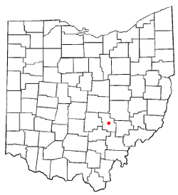
Location of New Lexington, Ohio
|
|

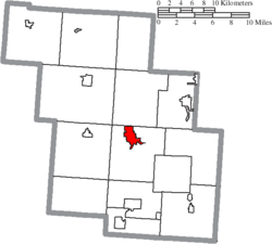
Location of New Lexington in Perry County
|
|
| Country | United States |
| State | Ohio |
| County | Perry |
| Area | |
| • Total | 1.95 sq mi (5.05 km2) |
| • Land | 1.95 sq mi (5.04 km2) |
| • Water | 0.00 sq mi (0.01 km2) |
| Elevation | 929 ft (283 m) |
| Population
(2020)
|
|
| • Total | 4,435 |
| • Density | 2,277.86/sq mi (879.31/km2) |
| Time zone | UTC-5 (Eastern (EST)) |
| • Summer (DST) | UTC-4 (EDT) |
| ZIP code |
43764
|
| Area code(s) | 740 |
| FIPS code | 39-54866 |
| GNIS feature ID | 2399471 |
| Website | https://www.newlexingtonohio.gov/ |
New Lexington is a village in and the county seat of Perry County, Ohio, United States, 21 miles (34 km) southwest of Zanesville and 45 miles (72 km) miles southeast of Columbus. The population was 4,435 at the 2020 census.
History

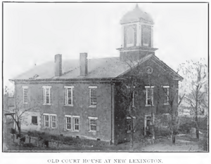
New Lexington was laid out in 1817. The village was named after Lexington, Massachusetts. A post office called New Lexington has been in operation since 1829. The Perry County Courthouse that stands at the corner of Main Street and West Brown Street was erected in 1887 and was dedicated one year later. In 2020, New Lexington’s historical Main Street underwent a massive renovation project that delivered new brick sidewalks, trash cans, benches, trees, and decorative street lighting. The project cost $2.1 million and was made possible through the Streetscape Grant.
Geography
According to the United States Census Bureau, the village has a total area of 1.95 square miles (5.05 km2), all land.
Climate
| Climate data for New Lexington, Ohio (1991–2020 normals, extremes 1942–present) | |||||||||||||
|---|---|---|---|---|---|---|---|---|---|---|---|---|---|
| Month | Jan | Feb | Mar | Apr | May | Jun | Jul | Aug | Sep | Oct | Nov | Dec | Year |
| Record high °F (°C) | 75 (24) |
78 (26) |
86 (30) |
102 (39) |
94 (34) |
100 (38) |
103 (39) |
100 (38) |
101 (38) |
91 (33) |
88 (31) |
77 (25) |
103 (39) |
| Mean daily maximum °F (°C) | 37.1 (2.8) |
40.5 (4.7) |
50.6 (10.3) |
63.9 (17.7) |
72.8 (22.7) |
80.2 (26.8) |
83.4 (28.6) |
82.6 (28.1) |
76.8 (24.9) |
65.3 (18.5) |
52.8 (11.6) |
41.7 (5.4) |
62.3 (16.8) |
| Daily mean °F (°C) | 27.4 (−2.6) |
30.1 (−1.1) |
38.8 (3.8) |
50.1 (10.1) |
60.0 (15.6) |
68.3 (20.2) |
72.1 (22.3) |
70.8 (21.6) |
64.2 (17.9) |
52.5 (11.4) |
41.2 (5.1) |
32.6 (0.3) |
50.7 (10.4) |
| Mean daily minimum °F (°C) | 17.7 (−7.9) |
19.6 (−6.9) |
27.0 (−2.8) |
36.4 (2.4) |
47.2 (8.4) |
56.5 (13.6) |
60.8 (16.0) |
59.0 (15.0) |
51.6 (10.9) |
39.7 (4.3) |
29.7 (−1.3) |
23.5 (−4.7) |
39.1 (3.9) |
| Record low °F (°C) | −35 (−37) |
−26 (−32) |
−12 (−24) |
10 (−12) |
22 (−6) |
32 (0) |
40 (4) |
36 (2) |
24 (−4) |
14 (−10) |
−12 (−24) |
−24 (−31) |
−35 (−37) |
| Average precipitation inches (mm) | 3.35 (85) |
2.72 (69) |
3.84 (98) |
4.36 (111) |
4.34 (110) |
4.92 (125) |
4.55 (116) |
3.31 (84) |
3.20 (81) |
3.26 (83) |
3.21 (82) |
3.29 (84) |
44.35 (1,126) |
| Average snowfall inches (cm) | 8.6 (22) |
5.3 (13) |
2.8 (7.1) |
0.1 (0.25) |
0.0 (0.0) |
0.0 (0.0) |
0.0 (0.0) |
0.0 (0.0) |
0.0 (0.0) |
0.0 (0.0) |
0.4 (1.0) |
3.0 (7.6) |
20.2 (51) |
| Average precipitation days (≥ 0.01 in) | 13.5 | 11.3 | 11.9 | 12.1 | 13.4 | 11.7 | 11.1 | 9.6 | 8.7 | 10.2 | 10.3 | 13.4 | 137.2 |
| Average snowy days (≥ 0.1 in) | 5.5 | 3.9 | 2.2 | 0.1 | 0.0 | 0.0 | 0.0 | 0.0 | 0.0 | 0.0 | 0.5 | 2.7 | 14.9 |
| Source: NOAA | |||||||||||||
Demographics
| Historical population | |||
|---|---|---|---|
| Census | Pop. | %± | |
| 1850 | 406 | — | |
| 1860 | 812 | 100.0% | |
| 1870 | 953 | 17.4% | |
| 1880 | 1,357 | 42.4% | |
| 1890 | 1,470 | 8.3% | |
| 1900 | 1,701 | 15.7% | |
| 1910 | 2,559 | 50.4% | |
| 1920 | 3,157 | 23.4% | |
| 1930 | 3,901 | 23.6% | |
| 1940 | 4,049 | 3.8% | |
| 1950 | 4,233 | 4.5% | |
| 1960 | 4,514 | 6.6% | |
| 1970 | 4,921 | 9.0% | |
| 1980 | 5,179 | 5.2% | |
| 1990 | 5,117 | −1.2% | |
| 2000 | 4,689 | −8.4% | |
| 2010 | 4,731 | 0.9% | |
| 2020 | 4,435 | −6.3% | |
| U.S. Decennial Census | |||
2010 census
As of the census of 2010, there were 4,731 people, 1,838 households, and 1,164 families living in the village. The population density was 2,426.2 inhabitants per square mile (936.8/km2). There were 2,000 housing units at an average density of 1,025.6 per square mile (396.0/km2). The racial makeup of the village was 97.9% White, 0.5% African American, 0.2% Native American, 0.1% Asian, 0.1% Pacific Islander, 0.1% from other races, and 1.1% from two or more races. Hispanic or Latino of any race were 0.6% of the population.
There were 1,838 households, of which 36.3% had children under the age of 18 living with them, 39.9% were married couples living together, 17.8% had a female householder with no husband present, 5.6% had a male householder with no wife present, and 36.7% were non-families. 30.6% of all households were made up of individuals, and 11.1% had someone living alone who was 65 years of age or older. The average household size was 2.53 and the average family size was 3.12.
The median age in the village was 33.8 years. 28.2% of residents were under the age of 18; 9.1% were between the ages of 18 and 24; 26.3% were from 25 to 44; 23.3% were from 45 to 64; and 13.3% were 65 years of age or older. The gender makeup of the village was 47.3% male and 52.7% female.
Education
New Lexington City School District operates New Lexington Elementary, Junction City Elementary, New Lexington Middle School, and New Lexington High School.
New Lexington has a public library, a branch of the Perry County District Library.
Notable people
- William A. Calderhead, U.S. Representative from Kansas
- James M. Comly, brigadier general in Union Army, journalist, attorney and diplomat
- Dan Dodd, member of the Ohio House of Representatives
- Stephen Benton Elkins, industrialist and politician
- William C. Grimes, acting Governor of Oklahoma Territory
- Januarius MacGahan, journalist and national hero of Bulgaria
- Jerry McGee - professional golfer
- John A. McShane, first Democrat elected to United States House of Representatives from Nebraska
- Albert Francis Zahm - specialist in aerodynamics; early aircraft experimenter
- John Augustine Zahm - Holy Cross priest and scientist
See also
 In Spanish: New Lexington (Ohio) para niños

