Necker Island (Hawaii) facts for kids
Quick facts for kids |
|
|
Necker Island Archeological District
|
|
 |
|
| Nearest city | Pu'uwai, Ni'ihau, Kaua'i County Hawaii |
|---|---|
| Area | 45.193 acres (182,890 m2) |
| NRHP reference No. | 88000641 |
| Added to NRHP | June 13, 1988 |
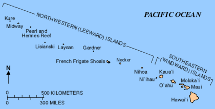
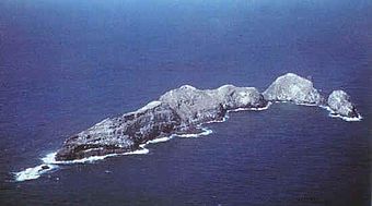
Necker Island (Hawaiian: Mokumanamana) is a small island in the Northwestern Hawaiian Islands. It is located at 23°34′30″N 164°42′01″W / 23.57500°N 164.70028°W in the Pacific Ocean, 155 miles (135 nmi; 249 km) northwest of Nihoa and 8 miles (7.0 nmi; 13 km) north of the Tropic of Cancer. It contains important prehistoric archaeological sites of the Hawaiian culture and is part of the Hawaiian Islands National Wildlife Refuge within the Northwestern Hawaiian Islands National Monument.
The United States Census Bureau reports its land area as 45.193 acres (182,890 m2). The island is rocky with steep sides and has very little soil. Its highest elevation is 277 feet (84 m). The island is named after Jacques Necker, a finance minister of Louis XVI.
Geography & Ecology
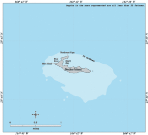
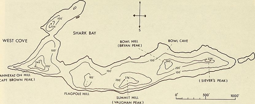
Necker island is about 1.1 km long rocky ridge about 100 meters wide with a hook shape. The hook is on the west end and hooks around what is called Shark Bay on the north side of the island. Total area is about 41 acres.
The westernmost land is called Mo'o point, and the northern most point is called the Northwest cape. Between Mo'o and Northwest Cap is West Cove.
The ridge of the island has five peaks along it:
- Siever's Peak (61 m high) - easternmost
- Bowl hill (79 m)
- Summit hill (84 m)
- Flagpole hill (56.4 m)
- Annexation peak (75 m)
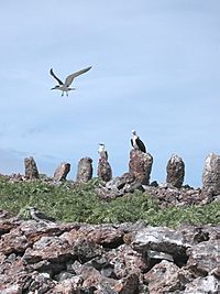
The island is covered in some low shrubs and grasses. The island is also noted for large numbers of birds.
Five species of plants known to occur include:
- Goosefoot shrub (Chenopodium sandwicheum)
- The bunch grass (Panicum torridum) (i.e. kakonakona)
- Purslane (Portulaca lutea) (i.e. ihi weed)
- Pickle weed (Sesuvium portulacastrum)
- ohai shrub (Sesbania tomentasa)
The seabird, the Blue-Grey Noddy was first discovered at Necker island in 1903. It is thought about 16 species of seabirds nest on Necker island, in the populations of tens of thousands of birds.
The waters around Necker island have been studied for their fish populations and type. Deep sea fish types that live hundreds of meters/yards under water on the Necker sea mount include Stomiiformes, Gadiformes, Myctophiformes, and Aulopiformes.
Settlement remains
The island contains dozens of stone artifact sites which are thought to be ritual shrines. There are not many signs of long-term habitation, giving rise to the theory that people visited the island for short periods instead of settling it. Many anthropologists believe that the island was a ceremonial and religious site. According to the myths and legends of the people of Kauai, which lies to the southeast, Necker Island was the last known refuge for a race of mythical "little people" called the Menehune. According to the legend, the Menehune settled on Necker after being chased off Kaua'i by the stronger Polynesians and subsequently built the various stone structures there. Visits to the island are said to have started a few hundred years after the main Hawaiian Islands were inhabited, and ended a few hundred years before European contact. French explorer Jean-François de La Pérouse was the first European to visit the island, in 1786. The island is named after Jacques Necker. The islands were formally annexed in 1894 by the Provisional Government of Hawaii.
Because of the island's usage by Native Hawaiians as a ceremonial and religious site in Ancient Hawaii, the island was added to the National Register of Historic Places in 1988.
Numerous artifacts have been found on visits to the island, and among the most mysterious are a dozen or so carved stone sculptures of little neckless people. The sculptures are not more then a foot and half long, and do not match style of Hawaii or other Polynesian idols.
Artifacts found on the island include the stone images, carved stone bowls, and various tools.
History
Necker island is believed to be 10 million years old according to early 21st century geological research. It is thought that while it is only about 100 meters above sea level now, it used to be a kilometer in altitude.
The island was discovered by French explorer Compte de La Pérouse in 1786. His ships were L'Astrolabe (under command of Fleuriot de Langle) and the La Boussole. La Perouse was on a mission of exploration from the French Academy of Sciences, and they made many discoveries in across the Pacific;they had also just discovered tje French Frigate Shoals ( Basse des Frégates Françaises) (and his namesake rock La Perouse Pinnacle). The expedition were lost at sea in 1788, but were able to send their logs home.
The abandoned settlements seen by the early explorers caused Nihoa and Necker islands, to be called the 'mystery islands'.
In 1859 the position of Necker island was determined by Lieutenant J.M. Brook the survey schooner, USS Fenimore Cooper.
In the 1890s is was considered as potential waypoint location for a Pacific cable between Canada and Australia. (see also All Red Line for the British telegraph network)
In 1902, the ship Albatross from the U.S. Fish Commission visited Necker island, was able to discover the Blue-grey noddy bird, which was named the Necker island tern.
The United States Revenue Cutter Service visited the island in 1910 and 1913 with the ship USRC Thetis.
The warden of the Hawaiian Islands Bird Reservation visited the island in 1919, and also found part of stone artifact.
The Tanager expedition visited the island in early 1920s, which is noted for exploring the islands biology and archeology.
In the early 21st century Necker island was a place of study for benthic invertebrates and algal assembliges.
Gallery
Map
See also
 In Spanish: Isla Necker para niños


