National Register of Historic Places listings in Randolph County, Indiana facts for kids
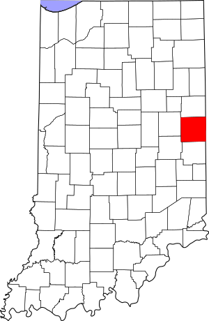
This is a list of the National Register of Historic Places listings in Randolph County, Indiana.
This is intended to be a complete list of the properties and districts on the National Register of Historic Places in Randolph County, Indiana, United States. Latitude and longitude coordinates are provided for many National Register properties and districts; these locations may be seen together in a map.
There are 14 properties and districts listed on the National Register in the county.
Properties and districts located in incorporated areas display the name of the municipality, while properties and districts in unincorporated areas display the name of their civil township. Properties and districts split between multiple jurisdictions display the names of all jurisdictions.
Current listings
| Name on the Register | Image | Date listed | Location | City or town | Description | |
|---|---|---|---|---|---|---|
| 1 | Farmland Downtown Historic District |
(#94001124) |
Main St. from the alley south of Henry St. to William St. 40°11′27″N 85°07′42″W / 40.190833°N 85.128333°W |
Farmland | ||
| 2 | Fudge Site |
(#07000213) |
Immediately southwest of the confluence of Sugar Creek and the White River, northwest of Winchester 40°11′08″N 84°59′27″W / 40.185556°N 84.990833°W |
White River Township | ||
| 3 | William Kerr House |
(#87001776) |
501 N. Columbia St. 40°12′08″N 84°48′33″W / 40.202222°N 84.809167°W |
Union City | Designed by architect George Franklin Barber | |
| 4 | Raphael Kirshbaum Building |
(#90000813) |
Northwestern corner of the junction of Columbia and W. Pearl Sts. 40°11′55″N 84°48′30″W / 40.198611°N 84.808333°W |
Union City | ||
| 5 | Gen. Asahel Stone Mansion |
(#79000040) |
201 W. Orange St. 40°09′56″N 84°58′58″W / 40.165556°N 84.982778°W |
Winchester | ||
| 6 | Union City Commercial Historic District |
(#99000303) |
Roughly bounded by W. Oak, N. Union, W. Smith, and N. Howard Sts. 40°11′56″N 84°48′30″W / 40.198889°N 84.808333°W |
Union City | ||
| 7 | Union City Passenger Depot |
(#83000145) |
Howard St. 40°11′52″N 84°48′36″W / 40.197778°N 84.810000°W |
Union City | ||
| 8 | Union City Public Library |
(#04000631) |
408 N. Columbia St. 40°12′06″N 84°48′30″W / 40.201667°N 84.808333°W |
Union City | ||
| 9 | Union City School |
(#10000379) |
310 N. Walnut St. 40°11′58″N 84°48′49″W / 40.199444°N 84.813611°W |
Union City | ||
| 10 | Winchester Courthouse Square Historic District |
(#01000405) |
Roughly bounded by North St. and the alleys located to the east of Main St. 40°10′27″N 84°58′20″W / 40.174167°N 84.972222°W |
Winchester | ||
| 11 | Winchester Residential Historic District |
(#11000123) |
Roughly both sides of Washington and Franklin Sts. from Main St. to Greenville Ave. and both sides of Meridian and Main Sts. 40°10′20″N 84°58′44″W / 40.172222°N 84.978889°W |
Winchester | ||
| 12 | Windsor Mound |
(#10000128) |
12102 W. Windsor Rd., south of Parker City 40°09′24″N 85°12′24″W / 40.156667°N 85.206667°W |
Stoney Creek Township |


